mapsExploring Florida
 FL Maps > County > Jefferson > Florida Waterways: Jefferson County Outline without Labels, 2008
Site Map 

Florida Waterways: Jefferson County Outline without Labels, 2008


Puzzle Directions: Click on a puzzle piece and drag it where you want it. When you connect two pieces correctly, they will join together. Mix up the pieces again. View finished map in pop-up window.

Title: Florida Waterways: Jefferson County Outline without Labels
Projection:
Source Bounding Coordinates:
W: E: N: S:

Back to Map Page
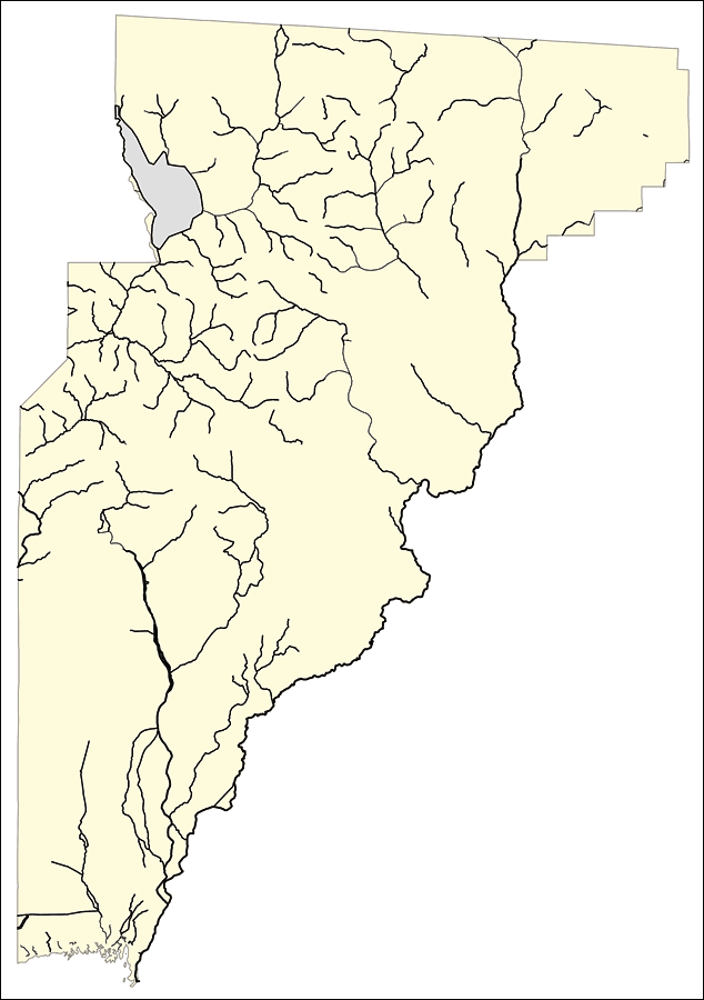
Description: This outline map was created by FCIT and shows the waterways of Jefferson County. All major rivers, streams, creeks, canals, bays and lakes are present, but not labeled. For a student activity sheet with directions for labeling the following: Lake Miccosukee, Aucilla River, Wolf Creek, Wacissa River, Apalachee Bay and St. Marks River click here.
Source: Florida Center for Instructional Technology, (Tampa, FL: University of South Florida, 2008)
Map Credit: Courtesy of the Florida Center for Instructional Technology
SearchLicensePDF HelpGIS Help Google Earth Help Zoomify Help

 FL Maps > County > Jefferson > Florida Waterways: Jefferson County Outline without Labels, 2008