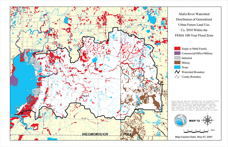
Description: This is a map from the Southwest Florida Watershed Management District or SWFWMD of the Alafia River watershed distribution generalized urban future land use circa 2010 within the FEMA 100-year flood zone created on May 7, 2001. The following urban land use classifications are shown by color: single or multi-family (red), commercial/office/military (purple), industrial (gray), and mining (brown). It also shows the Watershed Management boundary shown by the thick black line, US/State roads, inland water and county boundaries. "Future land use data were obtained from the Southwest Florida Regional Planning Council. The flood zone information was digitized from the Federal Emergency Management Agency's (FEMA) Flood Insurance Rate Map (FIRM) panels. These data were overlayed in the District's GIS to obtain the areas of urban future land use within the 100-year flood plain. The data are intended to provide a generalized view of this region." —Southwest Florida Watershed Management District
Place Names: 2000-, Alafia River, �Hillsborough, �Polk
ISO Topic Categories: boundaries, �inlandWaters, �transportation, �geoscientificInformation
Keywords: Alafia River Watershed Distribution of Generalized Urban Future Land Use, Ca. 2010 Within the FEMA 100-Year Flood Zone- Map 13, physical, �political, �transportation, �hydrological, �watershed, �kwatershed, physical features, county borders, roads, boundaries, �inlandWaters, �transportation, �geoscientificInformation, Unknown,May 7, 2001
Source: Southwest Florida Water Management District, Alafia River Comprehensive Watershed Management Plan Atlas (Brooksville, FL: Southwest Florida Water Management District, 2001)
Map Credit: Courtesy of the Southwest Florida Water Management District |
|