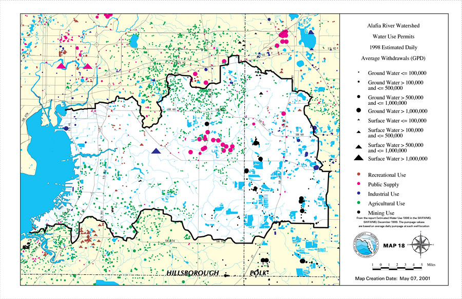
Description: This is a map from the Southwest Florida Watershed Management District or SWFWMD of the Alafia River watershed water use permits 1998 estimated daily average withdrawals (GPD), created on May 7, 2001. The following pumpage values are shown with black dots and triangles (least to most): Ground Water <= 100,000, Ground Water > 100,000 and <= 500,000, Ground Water > 500,000 and <= 1,000,000, Ground Water > 1,000,000, Surface Water <= 100,000, Surface Water > 100,000 and <= 500,000, Surface Water > 500,000 and <= 1,000,000, Surface Water > 1,000,000. The water use classifications shown by colored dots are: Recreational Use (brown), Public Supply (fuchsia), Industrial Use (blue), Agricultural Use (green), Mining Use (black). It also shows the Watershed Management boundary shown by the thick black line, US/State roads, inland water and county boundaries. "From the Estimated Water Use 1998 in the SWFWMD, SWFWMD, December 1999. The pumpage values are based on average daily pumpage at each well location." —Southwest Florida Watershed Management District
Place Names: 2000-, Alafia River, �Hillsborough, �Polk
ISO Topic Categories: boundaries, �inlandWaters, �transportation, �geoscientificInformation
Keywords: Alafia River Watershed Water Use Permits 1998 Estimated Daily Average Withdrawals (GPD)- Map 18, physical, �political, �transportation, �hydrological, �watershed, �kwatershed, physical features, county borders, roads, boundaries, �inlandWaters, �transportation, �geoscientificInformation, Unknown,May 7, 2001
Source: Southwest Florida Water Management District, Alafia River Comprehensive Watershed Management Plan Atlas (Brooksville, FL: Southwest Florida Water Management District, 2001)
Map Credit: Courtesy of the Southwest Florida Water Management District |
|