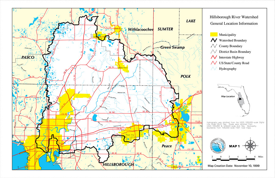
Description: This is a map from the Southwest Florida Watershed Management District or SWFWMD of the Hillsborough River watershed general location information created on November 10, 1999. This map shows the Watershed Management boundary shown by the thick black line, district basin boundary, hydrography with a light blue line and municipality shown with yellow highlighting. It also shows surrounding cities, inland water, county boundaries, interstate highways and US/State/County roads. "Hydrography was obtained from the USGS 1:100,000 scale Digital Line Graph (DLG) files. Roads were obtained from USGS 1:100,000 and 1:250,000 scale DLG files. Municipality boundaries from 1:126,000 scale FDOT road maps." —Southwest Florida Watershed Management District
Place Names: 1950-1999, Hillsborough River, �Hillsborough, �Polk, �Pasco, �Sumter, �Lake, �Withlacoochee River, �Peace River, �Lakeland, �Plant City, �Tampa, �Zephyrhills, �Mulberry
ISO Topic Categories: boundaries, �inlandWaters, �transportation, �geoscientificInformation
Keywords: Hillsborough River Watershed General Location Information- Map 1, physical, �political, �transportation, �hydrological, �watershed, �kwatershed, physical features, county borders, roads, boundaries, �inlandWaters, �transportation, �geoscientificInformation, Unknown,November 10, 1999
Source: Southwest Florida Water Management District, Hillsborough River Comprehensive Watershed Management Plan Atlas (Brooksville, FL: Southwest Florida Water Management District, 2000)
Map Credit: Courtesy of the Southwest Florida Water Management District |
|