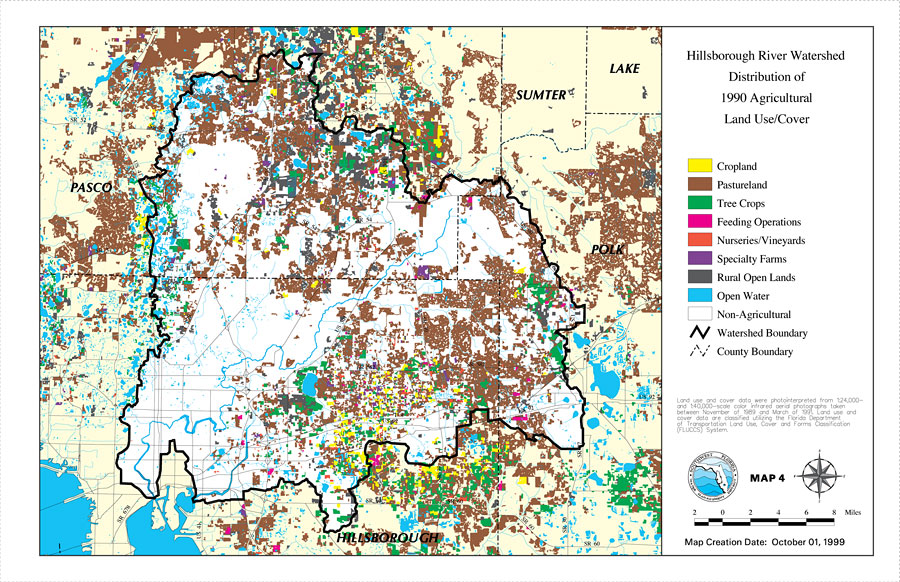
Description: This is a map from the Southwest Florida Watershed Management District or SWFWMD of the Hillsborough River watershed distribution of 1990 agricultural land use/cover created on October 1, 1999. This map shows the Watershed Management boundary shown by the thick black line. Agricultural land use/cover classifications shown are cropland (yellow), pastureland (brown), tree crops (green), feeding operations (fuchsia) , nurseries/vineyards (red), specialty farms (purple), rural open lands (dark gray) and open water (blue). It also shows non-agricultural land use (white), major roads, inland water, and county boundaries. "Land use and cover data were photointerpreted from 1:24,000 and 1:40,000 scale color infrared aerial photographs taken between November of 1989 and March of 1991. Land use and cover data are classified utilizing the Florida Department of Transportation Land Use, Cover and Forms Classification (FLUCCS) System." —Southwest Florida Watershed Management District
Place Names: 1950-1999, Hillsborough River, �Hillsborough, �Polk, �Pasco, �Sumter, �Lake
ISO Topic Categories: boundaries, �inlandWaters, �transportation, �geoscientificInformation
Keywords: Hillsborough River Watershed Distribution of 1990 Agricultural Land Use/Cover- Map 4, physical, �political, �transportation, �hydrological, �watershed, �kwatershed, physical features, county borders, roads, boundaries, �inlandWaters, �transportation, �geoscientificInformation, Unknown,October 1, 1999
Source: Southwest Florida Water Management District, Hillsborough River Comprehensive Watershed Management Plan Atlas (Brooksville, FL: Southwest Florida Water Management District, 2000)
Map Credit: Courtesy of the Southwest Florida Water Management District |
|