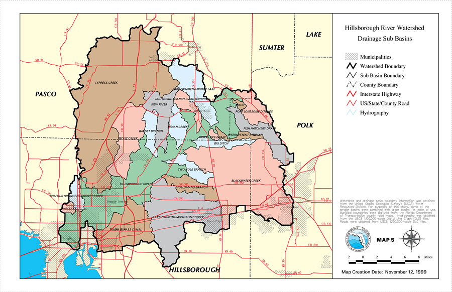
Description: This is a map from the Southwest Florida Watershed Management District or SWFWMD of the Hillsborough River watershed drainage sub basins created on November 12, 1999. Each sub basin is shown with the names and separated by colors. This map shows the Watershed Management boundary shown by the thick black line, the Sub Basin boundaries shown with a thin black line, and hydrography with a blue line. It also shows municipalities, US/State roads, inland water, and county boundaries. "Watershed and drainage basin boundary information was obtained from the United States Geological Survey's (USGS) Water Resources Division. For purposes of this study, some of the smaller basins were combined with larger basins for ease of use. Municipal boundaries were digitized from the Florida Department of Transportation county road maps. Hydrography was obtained from the USGS 1:100,000 scale Digital Line Graph (DLG) files. Roads were obtained from USGS 1:250,000 scale DLG files." —Southwest Florida Watershed Management District
Place Names: 1950-1999, Hillsborough River, �Hillsborough, �Polk, �Pasco, �Sumter, �Lake, �Cypress Creek, �Lake Thonotosassa, �Flint Creek, �Blackwater Creek, �Tampa Bypass Canal, �Sulphur Springs, �Lake Pasadena, �Buddy Lake, �Basset Branch, �Hollomans Branch, �Tampa
ISO Topic Categories: boundaries, �inlandWaters, �transportation, �geoscientificInformation
Keywords: Hillsborough River Watershed Drainage Sub Basins- Map 5, physical, �political, �transportation, �hydrological, �watershed, �kwatershed, physical features, county borders, roads, boundaries, �inlandWaters, �transportation, �geoscientificInformation, Unknown,November 12, 1999
Source: Southwest Florida Water Management District, Hillsborough River Comprehensive Watershed Management Plan Atlas (Brooksville, FL: Southwest Florida Water Management District, 2000)
Map Credit: Courtesy of the Southwest Florida Water Management District |
|