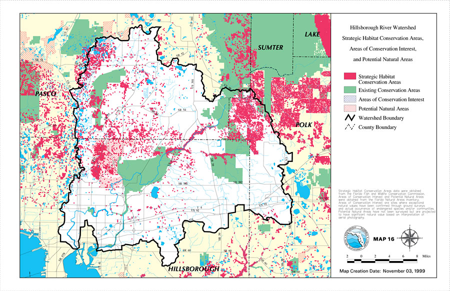
Description: This is a map from the Southwest Florida Watershed Management District or SWFWMD of the Hillsborough River watershed strategic habitat conservation area, areas of conservation interest and potential natural areas, created on November 3, 1999. The following classifications are shown by color: Strategic Habitat Conservation Areas (fuchsia), Existing Conservation Areas (green), Areas of Conservation Interest (blue crosshatch), and Potential Natural Areas (red crosshatch). It also shows the Watershed Management boundary shown by the thick black line, US/State roads, inland water and county boundaries. "Strategic Habitat Conservation Areas data were obtained from the Florida Fish and Wildlife Conservation Commission. Areas of Conservation interest and potential natural areas were obtained from the Florida Natural Areas Inventory. Areas of conservation interest are sites where exceptional natural values have been confirmed through ground surveys and actual occurrence of endangered species and/or communities. Potential natural areas have not been surveyed but are projected to have significant natural value based on interpretation of aerial photography." —Southwest Florida Watershed Management District
Place Names: 1950-1999, Hillsborough River, �Hillsborough, �Polk, �Pasco, �Sumter, �Lake
ISO Topic Categories: boundaries, �inlandWaters, �transportation, �geoscientificInformation
Keywords: Hillsborough River Watershed Strategic Habitat Conservation Areas, Areas of Conservation Interest, and Potential Natural Areas- Map 16, physical, �political, �transportation, �hydrological, �watershed, �kwatershed, physical features, county borders, roads, boundaries, �inlandWaters, �transportation, �geoscientificInformation, Unknown,November 3, 1999
Source: Southwest Florida Water Management District, Hillsborough River Comprehensive Watershed Management Plan Atlas (Brooksville, FL: Southwest Florida Water Management District, 2000)
Map Credit: Courtesy of the Southwest Florida Water Management District |
|