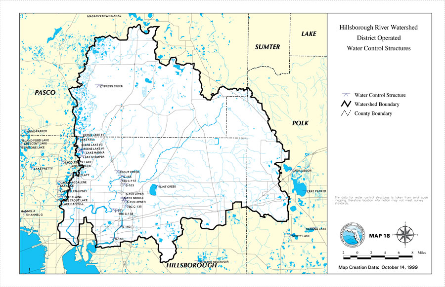
Description: This is a map from the Southwest Florida Watershed Management District or SWFWMD of the Hillsborough River watershed district operated water control structures, created on October 14, 1999. The water control structures are shown with a blue symbol. It also shows the Watershed Management boundary shown by the thick black line, US/State roads, inland water and county boundaries. Some of the water control structures shown are Lake Gibson, Lake Parker, Trout Creek, Lake Carroll, Keene Lake and Keystone Lake. "The data for water control structures is taken from small scale mapping, therefore location information may not meet survey standards." —Southwest Florida Watershed Management District
Place Names: 1950-1999, Hillsborough River, �Hillsborough, �Polk, �Pasco, �Sumter, �Lake, �Lake Gibson, �Lake Parker, �Scott Lake, �Banana Lake, �Flint Creek, �Trout Creek, �Lake Carroll, �Lake Magdalene, �Keene Lake, �Lake Stemper, �Island Ford Lake, �Cypress Creek
ISO Topic Categories: boundaries, �inlandWaters, �transportation, �geoscientificInformation
Keywords: Hillsborough River Watershed District Operated Water Control Structures- Map 18, physical, �political, �transportation, �hydrological, �watershed, �kwatershed, physical features, county borders, roads, boundaries, �inlandWaters, �transportation, �geoscientificInformation, Unknown,October 14, 1999
Source: Southwest Florida Water Management District, Hillsborough River Comprehensive Watershed Management Plan Atlas (Brooksville, FL: Southwest Florida Water Management District, 2000)
Map Credit: Courtesy of the Southwest Florida Water Management District |
|