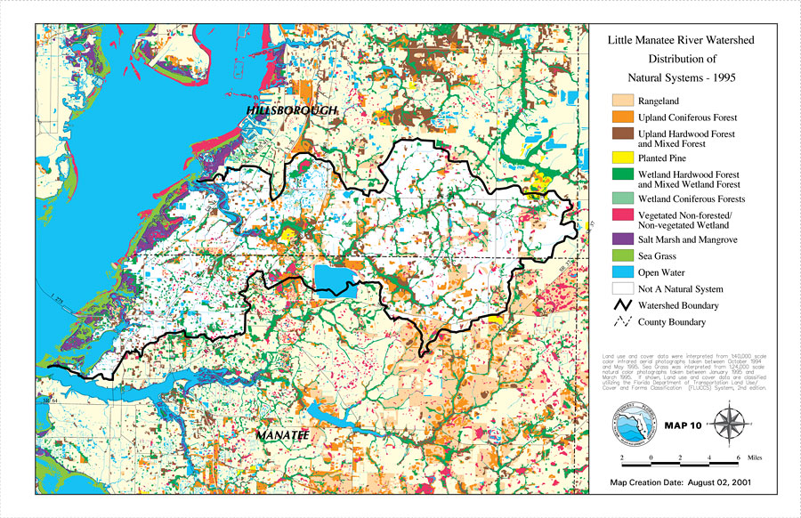
Description: This is a map from the Southwest Florida Watershed Management District or SWFWMD of the Little Manatee River watershed distribution of natural systems from 1995, created on August 2, 2001. The following natural system classifications are shown by color: rangeland (beige), upland coniferous forest (orange), upland hardwood forest and mixed forest (brown), planted pine (yellow), wetland hardwood forest and mixed wetland forest (green), wetland coniferous forest (light green), vegetated non-forested/non-vegetated wetland (fuchsia), salt marsh and mangrove (purple), sea grass (bright green), and open water (blue). It also shows places that are not natural systems (white), the Watershed Management boundary shown by the thick black line, US/State roads, inland water and county boundaries. "Land use and cover data were interpreted from 1:40,000 scale color infrared aerial photographs taken between October 1994 and May 1995. Seagrass was interpreted from 1:24,000 scale natural color photographs taken between January 1995 and March 1995. If shown, land use and cover data are classified utilizing the Florida Department of Transportation Land Use, Cover and Forms Classification (FLUCCS) System, 2nd edition." —Southwest Florida Watershed Management District
Place Names: 2000-, Little Manatee River, �Hillsborough, �Manatee
ISO Topic Categories: boundaries, �inlandWaters, �transportation, �geoscientificInformation
Keywords: Little Manatee River Watershed Distribution of Natural Systems - 1995- Map 10, physical, �political, �transportation, �hydrological, �watershed, �kwatershed, physical features, county borders, roads, boundaries, �inlandWaters, �transportation, �geoscientificInformation, Unknown,August 2, 2001
Source: Southwest Florida Water Management District, Little Manatee River Comprehensive Watershed Management Plan Atlas (Brooksville, FL: Southwest Florida Water Management District, 2002)
Map Credit: Courtesy of the Southwest Florida Water Management District |
|