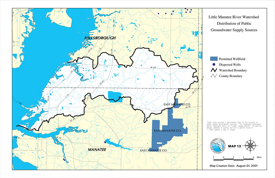
Description: This is a map from the Southwest Florida Watershed Management District or SWFWMD of the Little Manatee River watershed distribution of public groundwater supply sources, created on August 1, 2001. This map shows permitted wellfields (dark blue) and dispersed wells (dark purple dot). It also shows the Watershed Management boundary shown by the thick black line, US/State roads, inland water and county boundaries. "These data provide a generalized view of the location of public supply groundwater sources. The dispersed withdrawal points represent parts of a public supply permit. All permits shown, wellfield or points, are for a permit total of 1 million gallons a day or larger." —Southwest Florida Watershed Management District
Place Names: 2000-, Little Manatee River, �Hillsborough, �Manatee
ISO Topic Categories: boundaries, �inlandWaters, �transportation, �geoscientificInformation
Keywords: Little Manatee River Watershed Distribution of Public Groundwater Supply Sources- Map 13, physical, �political, �transportation, �hydrological, �watershed, �kwatershed, physical features, county borders, roads, boundaries, �inlandWaters, �transportation, �geoscientificInformation, Unknown,August 1, 2001
Source: Southwest Florida Water Management District, Little Manatee River Comprehensive Watershed Management Plan Atlas (Brooksville, FL: Southwest Florida Water Management District, 2002)
Map Credit: Courtesy of the Southwest Florida Water Management District |
|