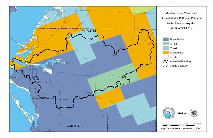
Description: This is a map from the Southwest Florida Watershed Management District or SWFWMD of the Manatee River ground water pollution potential to the Floridian aquifer created on December 11, 2000. The pollution potential is shown with a composite DRASTIC score from least to greatest by color; 59 and Below (blue), 60 - 64 (green), 65 - 69 (light blue), 70 and above (orange), and no data available (white). It also shows the Watershed Management boundary shown by the thick black line, US/State roads, inland water and county boundaries.
Place Names: 2000-, Manatee River, �Manatee, �Sarasota
ISO Topic Categories: boundaries, �inlandWaters, �transportation, �geoscientificInformation
Keywords: Manatee River Watershed Ground Water Pollution Potential to the Floridan Aquifer (D.R.A.S.T.I.C.)- Map 9, physical, �political, �transportation, �hydrological, �watershed, �kwatershed, physical features, county borders, roads, boundaries, �inlandWaters, �transportation, �geoscientificInformation, Unknown,December 11, 2000
Source: Southwest Florida Water Management District, Manatee River Comprehensive Watershed Management Plan Atlas (Brooksville, FL: Southwest Florida Water Management District, 2000)
Map Credit: Courtesy of the Southwest Florida Water Management District |
|