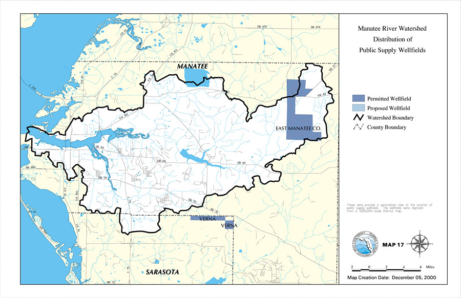
Description: This is a map from the Southwest Florida Watershed Management District or SWFWMD of the Manatee River watershed distribution of public supply wellfields, created on December 5, 2000. This map shows permitted wellfields (dark blue) and proposed wells (light blue). It also shows the Watershed Management boundary shown by the thick black line, US/State roads, inland water and county boundaries. "These data provide a generalized view of the location of public supply wellfields. The wellfields were digitized from a 1:500,000 scale district map." —Southwest Florida Watershed Management District
Place Names: 2000-, Manatee River, �Manatee, �Sarasota
ISO Topic Categories: boundaries, �inlandWaters, �transportation, �geoscientificInformation
Keywords: Manatee River Watershed Distribution of Public Supply Wellfields- Map 17, physical, �political, �transportation, �hydrological, �watershed, �kwatershed, physical features, county borders, roads, boundaries, �inlandWaters, �transportation, �geoscientificInformation, Unknown,December 5, 2000
Source: Southwest Florida Water Management District, Manatee River Comprehensive Watershed Management Plan Atlas (Brooksville, FL: Southwest Florida Water Management District, 2000)
Map Credit: Courtesy of the Southwest Florida Water Management District |
|