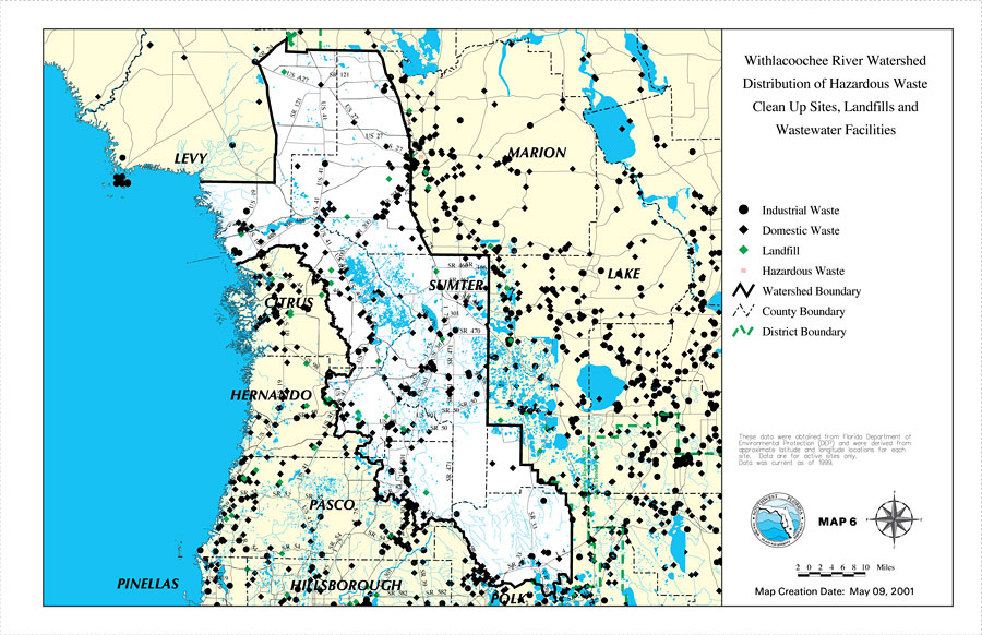
Description: This is a map from the Southwest Florida Watershed Management District or SWFWMD of the Withlacoochee River watershed distribution of hazardous waste clean up sites, landfills and wastewater facilities created on May 9, 2001. This map shows industrial waste with a black dot, domestic waste with a black diamond, landfills with a green diamond and hazardous waste shown with a red box with a red X inside. It also shows the Watershed Management boundary shown by the thick black line, district boundary (green dashed line), US/State roads, inland water, and county boundaries. "These data were obtained from Florida Department of Environmental Projection (DEP) and were derived from approximate latitude and longitude locations for each site. Data are for active sites only. Data was current as of 1999." —Southwest Florida Watershed Management District
Place Names: 2000-, counties, �Marion, �Lake, �Sumter, �Citrus, �Hernando, �Levy, �Pasco, �Pinellas, �Hillsborough, �Polk
ISO Topic Categories: boundaries, �geoscientificInformation, �inlandWaters, �transportation
Keywords: Withlacoochee River Watershed Distribution of Hazardous Waste Clean Up Sites, Landfills and Wastewater Facilities, physical, �political, �transportation, �hydrological, �watershed, �kwatershed, physical features, county borders, roads, boundaries, �geoscientificInformation, �inlandWaters, �transportation, Unknown,May 9, 2001
Source: Southwest Florida Water Management District, Withlacoochee River Comprehensive Watershed Management Plan Atlas (Brooksville, FL: Southwest Florida Water Management District, 2001)
Map Credit: Courtesy of the Southwest Florida Water Management District |
|