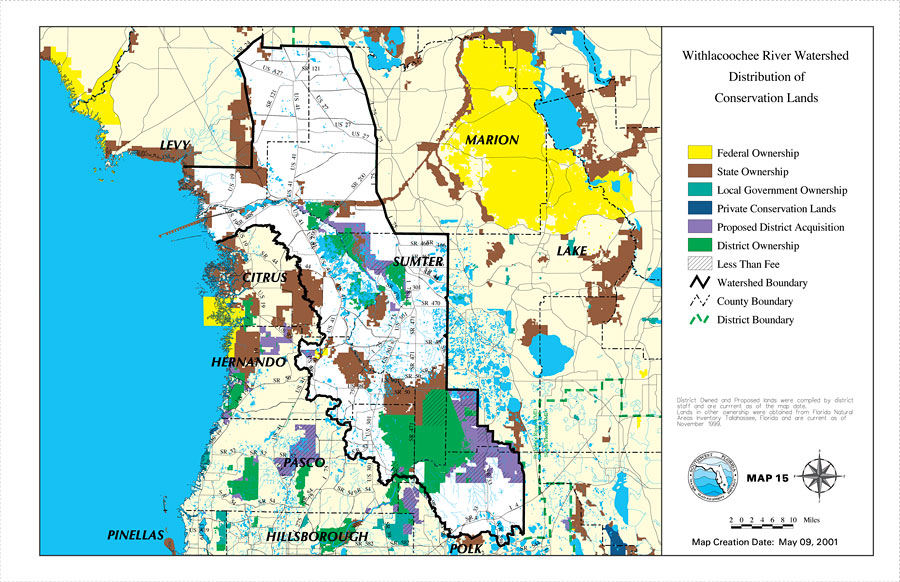
Description: This is a map from the Southwest Florida Watershed Management District or SWFWMD of the Withlacoochee River watershed distribution of conservation lands, created on May 9, 2001. The following ownership classifications are shown by color: Federal Ownership (yellow), State Ownership (brown), Local Government Ownership (teal), Private Conservation Lands (dark blue), Proposed District Acquisition (purple), District Ownership (green), and Less Than Fee (dashes). Less Than Fee means that someone has ownership, but with restricted rights because it is also conservation land. It also shows the Watershed Management boundary shown by the thick black line, district boundary (green dashed line), US/State roads, inland water and county boundaries. "District Owned and Proposed lands were compiled by district staff and are current as of the map date. Lands in other ownership were obtained from Florida Natural Areas Inventory Tallahassee, Florida and are current as of November 1999." —Southwest Florida Watershed Management District
Place Names: 2000-, counties, �Marion, �Lake, �Sumter, �Citrus, �Hernando, �Levy, �Pasco, �Pinellas, �Hillsborough, �Polk
ISO Topic Categories: boundaries, �geoscientificInformation, �inlandWaters, �transportation
Keywords: Withlacoochee River Watershed Distribution of Conservation Lands, physical, �political, �transportation, �hydrological, �watershed, �kwatershed, physical features, county borders, roads, boundaries, �geoscientificInformation, �inlandWaters, �transportation, Unknown,May 9, 2001
Source: Southwest Florida Water Management District, Withlacoochee River Comprehensive Watershed Management Plan Atlas (Brooksville, FL: Southwest Florida Water Management District, 2001)
Map Credit: Courtesy of the Southwest Florida Water Management District |
|