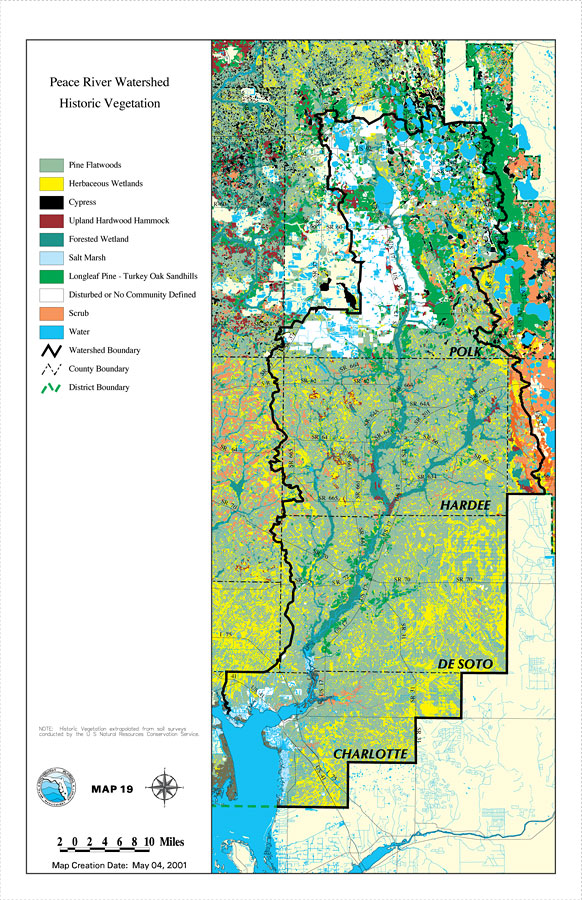
Description: This is a map from the Southwest Florida Watershed Management District or SWFWMD of the Peace River watershed historic vegetation, created on May 4, 2001. The following historic vegetation classifications are shown by color: Pine Flatwoods (light green), Herbaceous Wetlands (yellow), Cypress (black), Upland Hardwood Hammock (dark red), Forested Wetland (teal), Salt Marsh (light blue), Longleaf Pine - Turkey Oak Sandhills (green), Disturbed or No Community Defined (white), Scrub (orange), and water (blue). It also shows the Watershed Management boundary shown by the thick black line, district boundary (green dashed line), US/State roads, inland water and county boundaries. "Note: Historic Vegetation extrapolated from soil surveys conducted by the U. S. Natural Resources Conservation Service." —Southwest Florida Watershed Management District
Place Names: 2000-, counties, �Hardee, �Desoto, �Charlotte, �Polk, �Peace River
ISO Topic Categories: boundaries, �geoscientificInformation, �inlandWaters, �transportation
Keywords: Peace River Watershed Historic Vegetation, physical, �political, �transportation, �hydrological, �watershed, �kwatershed, physical features, county borders, roads, boundaries, �geoscientificInformation, �inlandWaters, �transportation, Unknown,May 4, 2001
Source: Southwest Florida Water Management District, Peace River Comprehensive Watershed Management Plan Atlas (Brooksville, FL: Southwest Florida Water Management District, 2001)
Map Credit: Courtesy of the Southwest Florida Water Management District |
|