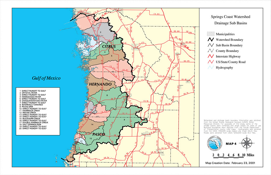
Description: This is a map from the Southwest Florida Watershed Management District or SWFWMD of the Springs Coast watershed drainage sub basins, created on February 23, 2001. Each sub basin is numbered shown to the left of the map. The sub basins are also separated by color on the map. This map shows the Watershed Management boundary shown by the thick black line, the Sub Basin boundaries shown with a thin black line, hydrography with a blue line, and intermittent hydrography with a dashed blue line. It also shows municipalities, US/State roads, inland water, and county boundaries. "Watershed and drainage basin boundary information was obtained from the United States Geological Survey's (USGS) Water Resources Division. For purposes of this study, some of the smaller basins were combined with larger basins for ease of use. Municipal boundaries were digitized from the Florida Department of Transportation county road maps. Hydrography was obtained from the USGS 1:100,000 scale Digital Line Graph (DLG) files. Roads were obtained from USGS 1:250,000 scale DLG files." —Southwest Florida Watershed Management District
Place Names: 2000-, counties, �Hernando, �Citrus, �Pasco, �Gulf of Mexico, �Springs Coast, �Crystal River, �Homosassa River, �Chassahowitzka River
ISO Topic Categories: boundaries, �geoscientificInformation, �inlandWaters, �transportation
Keywords: Springs Coast Watershed Drainage Sub Basins, physical, �political, �transportation, �hydrological, �watershed, �kwatershed, physical features, county borders, roads, boundaries, �geoscientificInformation, �inlandWaters, �transportation, Unknown,February 23, 2001
Source: Southwest Florida Water Management District, Springs Coast Comprehensive Watershed Management Plan Atlas (Brooksville, FL: Southwest Florida Water Management District, 2001)
Map Credit: Courtesy of the Southwest Florida Water Management District |
|