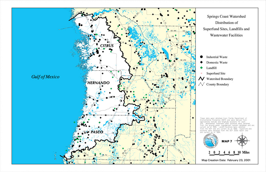
Description: This is a map from the Southwest Florida Watershed Management District or SWFWMD of the Springs Coast watershed distribution of superfund sites, landfills and wastewater facilities, created on February 23, 2001. This map shows industrial waste (black dot), domestic waste (black diamond), landfills (green diamond) and superfund sites (red box with a red X inside). It also shows the Watershed Management boundary shown by the thick black line, US/State roads, inland water, and county boundaries. "These data were obtained from Florida Department of Environmental Projection (DEP) and were derived from approximate latitude and longitude locations for each site. Wastewater treatment plant locations were obtained from the ground-water management system database and are current as of 1999. Landfill locations were obtained from the DEP and are current as of 1999. Superfund site locations were obtained from the DEP 305b report and are current as of 1994." —Southwest Florida Watershed Management District
Place Names: 2000-, counties, �Hernando, �Citrus, �Pasco, �Gulf of Mexico, �Springs Coast
ISO Topic Categories: boundaries, �geoscientificInformation, �inlandWaters, �transportation
Keywords: Springs Coast Watershed Distribution of Superfund Sites, Landfills and Wastewater Facilities, physical, �political, �transportation, �hydrological, �watershed, �kwatershed, physical features, county borders, roads, boundaries, �geoscientificInformation, �inlandWaters, �transportation, Unknown,February 23, 2001
Source: Southwest Florida Water Management District, Springs Coast Comprehensive Watershed Management Plan Atlas (Brooksville, FL: Southwest Florida Water Management District, 2001)
Map Credit: Courtesy of the Southwest Florida Water Management District |
|