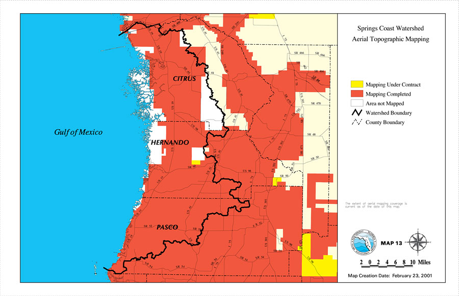
Description: This is a map from the Southwest Florida Watershed Management District or SWFWMD of the Springs Coast watershed Aerial Topographic Mapping, created on February 23, 2001. The following mapping areas are shown on the key: Mapping Under Contract (yellow), Mapping Completed (red), Area not Mapped (white). It also shows the Watershed Management boundary shown by the thick black line, US/State roads, inland water and county boundaries. "The extent of aerial mapping coverage is current as of the date of this map." —Southwest Florida Watershed Management District
Place Names: 2000-, counties, �Hernando, �Citrus, �Pasco, �Gulf of Mexico, �Springs Coast
ISO Topic Categories: boundaries, �geoscientificInformation, �inlandWaters, �transportation
Keywords: Springs Coast Watershed Aerial Topographic Mapping, physical, �political, �transportation, �hydrological, �watershed, �kwatershed, physical features, county borders, roads, boundaries, �geoscientificInformation, �inlandWaters, �transportation, Unknown,February 23, 2001
Source: Southwest Florida Water Management District, Springs Coast Comprehensive Watershed Management Plan Atlas (Brooksville, FL: Southwest Florida Water Management District, 2001)
Map Credit: Courtesy of the Southwest Florida Water Management District |
|