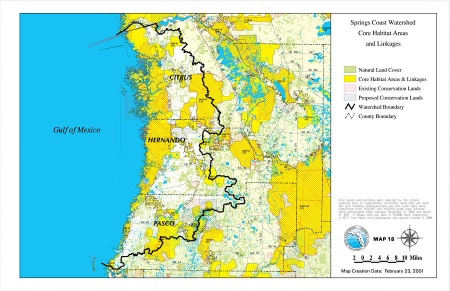
Description: This is a map from the Southwest Florida Watershed Management District or SWFWMD of the Springs Coast watershed core habitat areas and linkages, created on February 23, 2001. The following is shown on the key: Natural Land Cover (light green), Core Habitat Areas & Linkages (yellow), Existing Conservation Lands (red diagonal lines), Proposed Conservation Lands (blue diagonal lines). It also shows the Watershed Management boundary shown by the thick black line, US/State roads, inland water and county boundaries. "Core areas and corridors were selected by the natural systems area of responsibility committee using land use data and grid modeling techniques. Land use and cover data were interpreted from 1:24,000 and 1:40,000 scale color infrared aerial photographs taken between November of 1989 and March 1991. If shown, land use data in SFWMD were interpreted in 1977 from Mark Hurd photoquads and ground truthed in 1988." —Southwest Florida Watershed Management District
Place Names: 2000-, counties, �Hernando, �Citrus, �Pasco, �Gulf of Mexico, �Springs Coast
ISO Topic Categories: boundaries, �geoscientificInformation, �inlandWaters, �transportation
Keywords: Springs Coast Watershed Core Habitat Areas and Linkages, physical, �political, �transportation, �hydrological, �watershed, �kwatershed, physical features, county borders, roads, boundaries, �geoscientificInformation, �inlandWaters, �transportation, Unknown,February 23, 2001
Source: Southwest Florida Water Management District, Springs Coast Comprehensive Watershed Management Plan Atlas (Brooksville, FL: Southwest Florida Water Management District, 2001)
Map Credit: Courtesy of the Southwest Florida Water Management District |
|