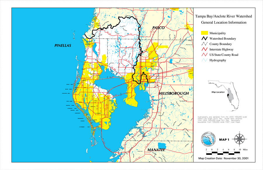
Description: This is a map from the Southwest Florida Watershed Management District or SWFWMD of the Tampa Bay/Anclote River watershed general location information, created on November 30, 2001. This map shows the Watershed Management boundary shown by the thick black line, hydrography with a light blue line and municipality shown with yellow highlighting. It also shows surrounding cities (mainly in Pinellas County), inland water, county boundaries, interstate highways and US/State/County roads. "Hydrography was obtained from the USGS 1:100,000 scale Digital Line Graph (DLG) files. Roads were obtained from USGS 1:100,000 scale DLG files. Municipality boundaries from 1:126,000 scale FDOT road maps." —Southwest Florida Watershed Management District
Place Names: 2000-, counties, �Pasco, �Tampa Bay, �Anclote River, �Hillsborough, �Manatee, �Pinellas, �New Port Richey, �Tarpon Springs, �Oldsmar, �Dunedin, �Clearwater, �Pinellas Park, �Seminole, �Largo, �Gulfport, �St. Petersburg, �Tampa
ISO Topic Categories: boundaries, �geoscientificInformation, �inlandWaters, �transportation
Keywords: Tampa Bay/Anclote River Watershed General Location Information, physical, �political, �transportation, �hydrological, �watershed, �kwatershed, physical features, county borders, roads, boundaries, �geoscientificInformation, �inlandWaters, �transportation, Unknown,November 30, 2001
Source: Southwest Florida Water Management District, Tampa Bay/Anclote River Comprehensive Watershed Management Plan Atlas (Brooksville, FL: Southwest Florida Water Management District, 2001)
Map Credit: Courtesy of the Southwest Florida Water Management District |
|