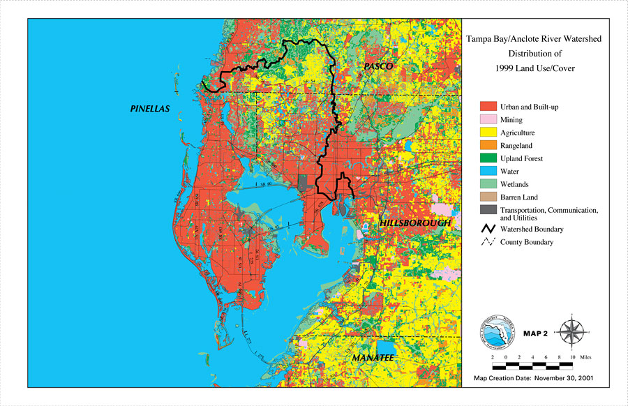
Description: This is a map from the Southwest Florida Watershed Management District or SWFWMD of the Tampa Bay/Anclote River watershed distribution of 1999 land use/cover, created on November 30, 2001. The watershed boundary is shown by a thick black line. Land use/cover classifications shown are urban and built-up (red), mining (pink), agriculture (yellow), rangeland (orange), upland forest (green), water (blue), wetlands (light green), barren land (light brown), and transportation, communication and utilities (dark gray). It also shows inland water, major roads and county boundaries.
Place Names: 2000-, counties, �Pasco, �Tampa Bay, �Anclote River, �Hillsborough, �Manatee, �Pinellas
ISO Topic Categories: boundaries, �geoscientificInformation, �inlandWaters, �transportation
Keywords: Tampa Bay/Anclote River Watershed Distribution of 1999 Land Use/Cover, physical, �political, �transportation, �hydrological, �watershed, �kwatershed, physical features, county borders, roads, boundaries, �geoscientificInformation, �inlandWaters, �transportation, Unknown,November 30, 2001
Source: Southwest Florida Water Management District, Tampa Bay/Anclote River Comprehensive Watershed Management Plan Atlas (Brooksville, FL: Southwest Florida Water Management District, 2001)
Map Credit: Courtesy of the Southwest Florida Water Management District |
|