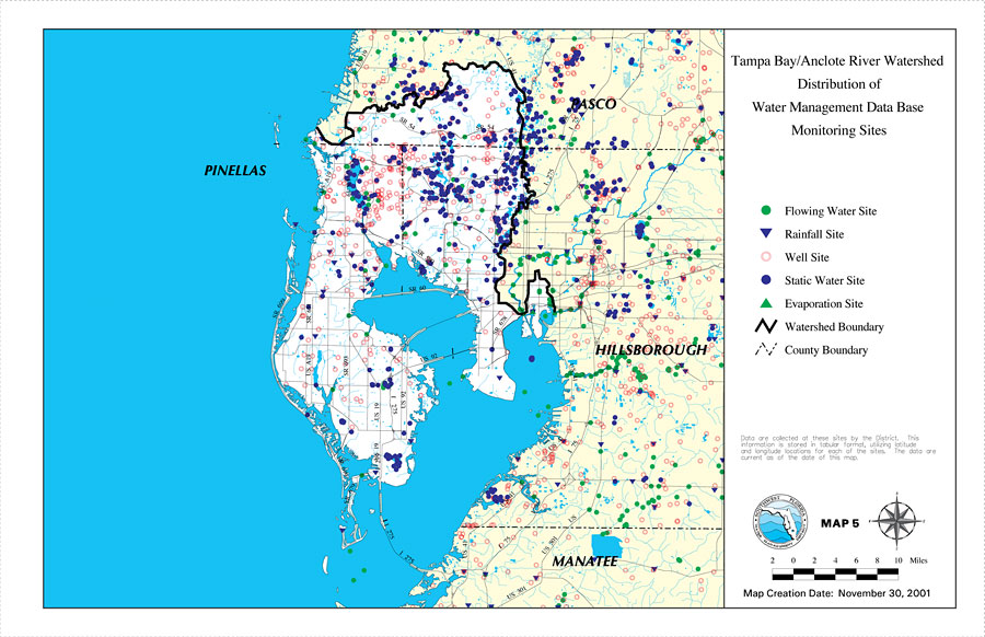
Description: This is a map from the Southwest Florida Watershed Management District or SWFWMD of the Tampa Bay/Anclote River watershed distribution of water management data base monitoring sites, created on November 30, 2001. This map shows the following monitoring sites: Flowing Water Site (green dot), Rainfall Site (purple triangle), Well Site (red circle), Static Water Site (purple dot), and Evaporation Site (green triangle). It also shows the Watershed Management boundary shown by the thick black line, US/State roads and county boundaries. "Data are collected at these sites by the District. This information is stored in a tabular format, utilizing latitude and longitude locations for each of the sites. The data are current as of the date of this map." —Southwest Florida Watershed Management District
Place Names: 2000-, counties, �Pasco, �Tampa Bay, �Anclote River, �Hillsborough, �Manatee, �Pinellas
ISO Topic Categories: boundaries, �geoscientificInformation, �inlandWaters, �transportation
Keywords: Tampa Bay/Anclote River Watershed Distribution of Water Management Data Base Monitoring Sites, physical, �political, �transportation, �hydrological, �watershed, �kwatershed, physical features, county borders, roads, boundaries, �geoscientificInformation, �inlandWaters, �transportation, Unknown,November 30, 2001
Source: Southwest Florida Water Management District, Tampa Bay/Anclote River Comprehensive Watershed Management Plan Atlas (Brooksville, FL: Southwest Florida Water Management District, 2001)
Map Credit: Courtesy of the Southwest Florida Water Management District |
|