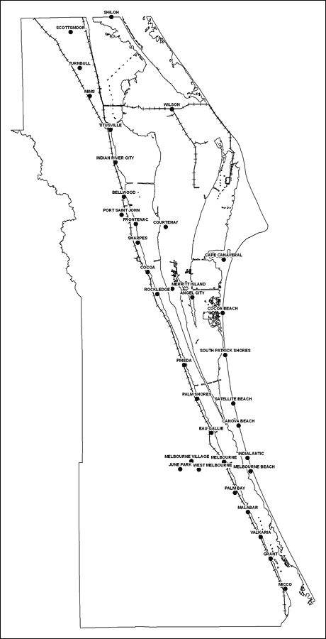
Description: This is a black and white railroad map of Brevard county, 2009. It also shows location of cities and towns including Melbroune and Cape Canaveral.
Place Names: Brevard, Scottsmoor, �Shiloh, �Turnbull, �Mims, �Wilson, �Titusville, �Indian River City, �Indian River, �Bellwood, �Port Saint John, �Frontenac, �Courtenay, �Sharpes, �Cape Canaveral, �Cocoa Beach, �Merritt Island, �Angel City, �Rockledge, �Cocoa, �Satellite Beach, �Pineda, �Melbourne, �Eau Gallie, �Indialantic, �Palm Bay, �Malabar, �Grant, �Micco, �South Patrick Shores, �Canova Beach, �Palm Shores, �Melbourne Beach, �Melbourne Village, �June Park, �West Melbourne, �Valkaria
ISO Topic Categories: boundaries, �transportation
Keywords: Brevard County Railway Network- Black and White, physical, �transportation, �political, county borders, railroads, boundaries, �transportation, Albers_Conical_Equal,2009
Source: Florida Center for Instructional Technology, Exploring Florida: Social Studies Resources �for Students and Teachers (Tampa, FL: University of South Florida, 2009)
Map Credit: Courtesy of the Florida Center for Instructional Technology, Author: Samer Slaiby |
|