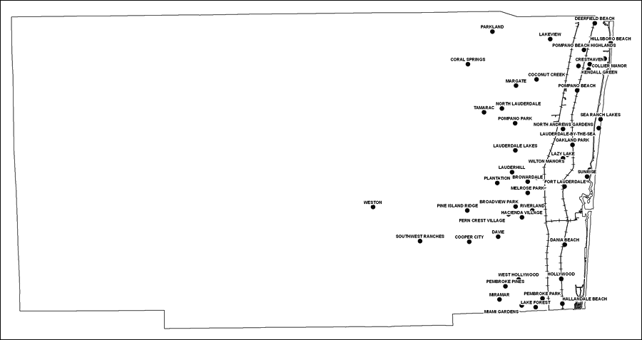
Description: This is a black and white railroad map of Broward county, 2009. It also shows location of cities and towns including Hallandale and Ft. Lauderdale.
Place Names: Broward, Lauderhill, �Lauderdale Lakes, �Ft. Lauderdale, �Pembroke Pines, �Hollywood, �Miramar, �Deerfield Beach, �Lakeview, �Pompano Beach Highlands, �Hillsboro Beach, �Cresthaven, �Collier Manor, �Kendall Green, �Pompano Beach, �Sea Ranch Lakes, �North Lauderdale, �Pompano Park, �Tamarac, �Coral Springs, �Parkland, �North Andrews Gardens, �Lauderdale-by-the-Sea, �Lazy Lake, �Wilton Manors, �Sunrise, �Oakland Park, �Plantation, �Browardale, �Melrose Park, �Fort Lauderdale, �Riverland, �Broadview Park, �Pine Island Ridge, �Fern Crest Village, �Cooper City, �Davie, �Dania Beach, �West Hollywood, �Hallandale Beach, �Lake Forest, �Pembroke Park, �Miami Gardens, �Southwest Ranches, �Weston
ISO Topic Categories: boundaries, �transportation
Keywords: Broward County Railway Network- Black and White, physical, �transportation, �political, county borders, railroads, boundaries, �transportation, Albers_Conical_Equal,2009
Source: Florida Center for Instructional Technology, Exploring Florida: Social Studies Resources �for Students and Teachers (Tampa, FL: University of South Florida, 2009)
Map Credit: Courtesy of the Florida Center for Instructional Technology, Author: Samer Slaiby |
|