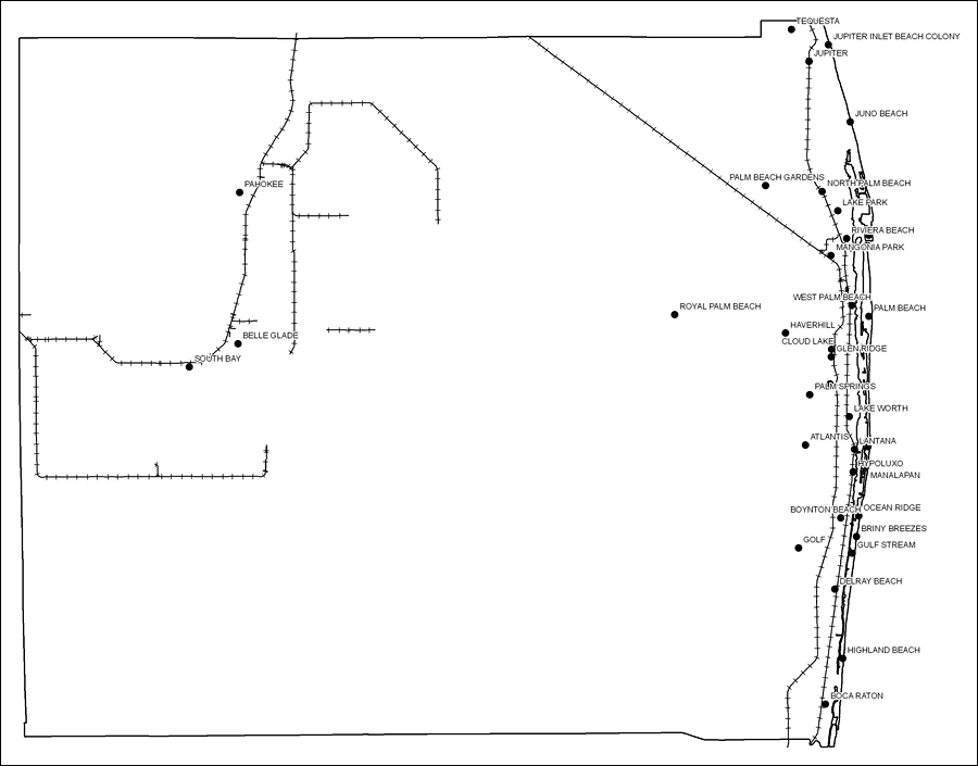
Description: This is a black and white railroad map of Palm Beach county, 2009. It also shows location of cities and towns including West Palm Beach and Boca Raton.
Place Names: Palm Beach, Pahokee, �Belle Glade, �South Bay, �Tequesta, �Jupiter, �Juno Beach, �Palm Beach, �Jupiter Inlet Beach Colony, �Palm Beach Gardens, �North Palm Beach, �Lake Park, �Riviera Beach, �Mangonia Park, �West Palm Beach, �Haverhill, �Cloud Lake, �Royal Palm Beach, �Glen Ridge, �Lake Worth, �Atlantis, �Lantana, �Hypoluxo, �Manalapan, �Boynton Beach, �Golf, �Briny Breezes, �Gulf Stream, �Delray Beach, �Highland Beach, �Boca Raton
ISO Topic Categories: boundaries, �transportation
Keywords: Palm Beach County Railway Network- Black and White, physical, �transportation, �political, county borders, railroads, boundaries, �transportation, Albers_Conical_Equal,2009
Source: Florida Center for Instructional Technology, Exploring Florida: Social Studies Resources �for Students and Teachers (Tampa, FL: University of South Florida, 2009)
Map Credit: Courtesy of the Florida Center for Instructional Technology, Author: Samer Slaiby |
|