mapsExploring Florida
 FL Maps > Tree Distribution > Tropical Hardwoods A-C > Bursera simaruba or gumbo-limbo, 1978
Site Map 

Bursera simaruba or gumbo-limbo, 1978


Puzzle Directions: Click on a puzzle piece and drag it where you want it. When you connect two pieces correctly, they will join together. Mix up the pieces again. View finished map in pop-up window.

Title: Bursera simaruba or gumbo-limbo
Projection: Unknown
Source Bounding Coordinates:
W: -88 E: -80 N: 31.5 S: 24

Back to Map Page
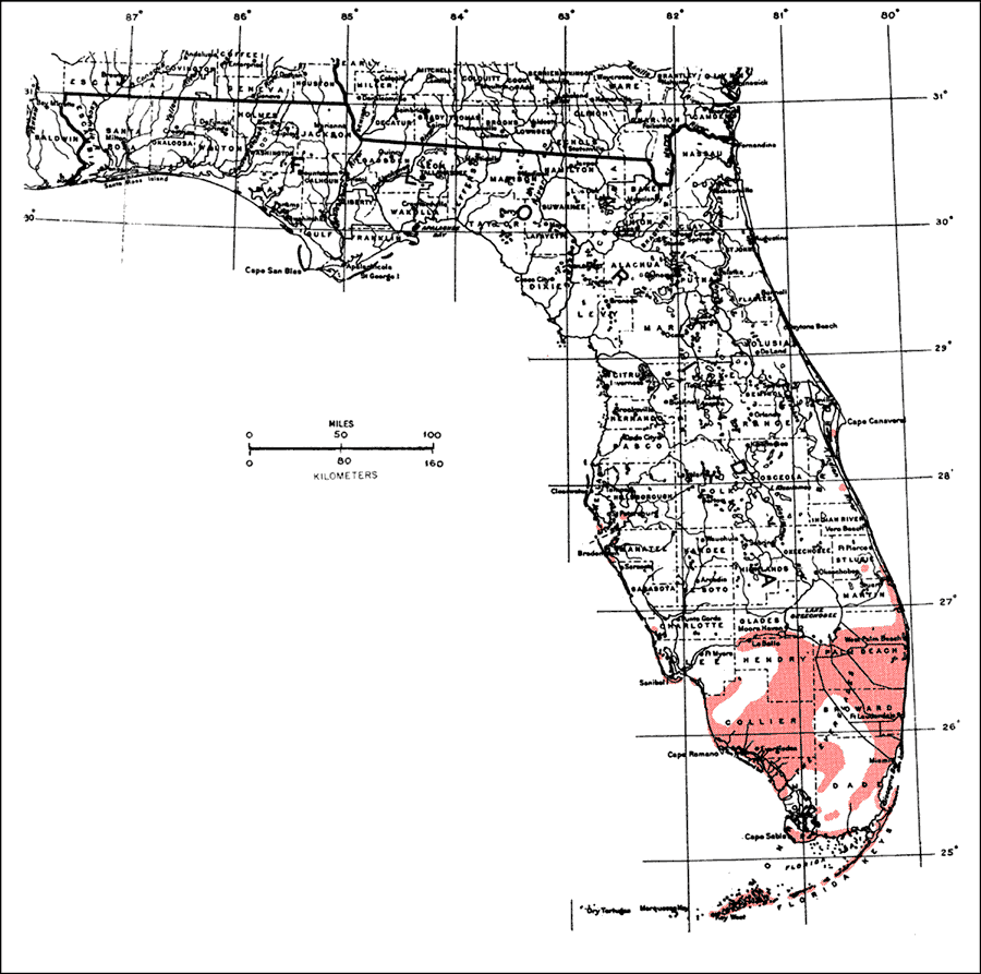
Description: This is a map showing the distribution of the Bursera simaruba or gumbo-limbo in Florida. "S. Florida including Florida Keys, n. near coasts to c. Florida. From Bahamas through West Indies including Puerto Rico and Virgin Is. Also from n. Mexico s. to Columbia, Venezuela and Guyana." —Elbert L. Little, Jr. For more information, read the introduction to the Atlas of United States Trees Vol. 5 Florida.
Source: Elbert L. Little, Jr., Atlas of United States Trees Volume 5 Florida (Washington, D.C.: United States Government Printing Office, 1978)
Map Credit: United States Government Printing Office
SearchLicensePDF HelpGIS Help Google Earth Help Zoomify Help

 FL Maps > Tree Distribution > Tropical Hardwoods A-C > Bursera simaruba or gumbo-limbo, 1978