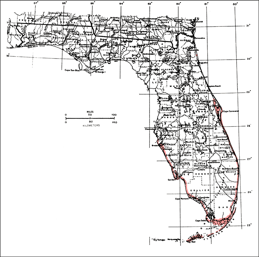
Description: This is a map showing the distribution of the Coccoloba uvifera or seagrape in Florida. "Shores of c. and s. Florida incl. Florida Keys. Also Bermuda and from Bahamas through West Indies including P.R. and V.I. Atlantic coast from n. Mexico to Columbia, Venezuela, and Guianas (Guyana). Introduced in Hawaii." —Elbert L. Little, Jr. For more information, read the introduction to the Atlas of United States Trees Vol. 5 Florida.
Source: Elbert L. Little, Jr., Atlas of United States Trees Volume 5 Florida (Washington, D.C.: United States Government Printing Office, 1978)
Map Credit: United States Government Printing Office |
|