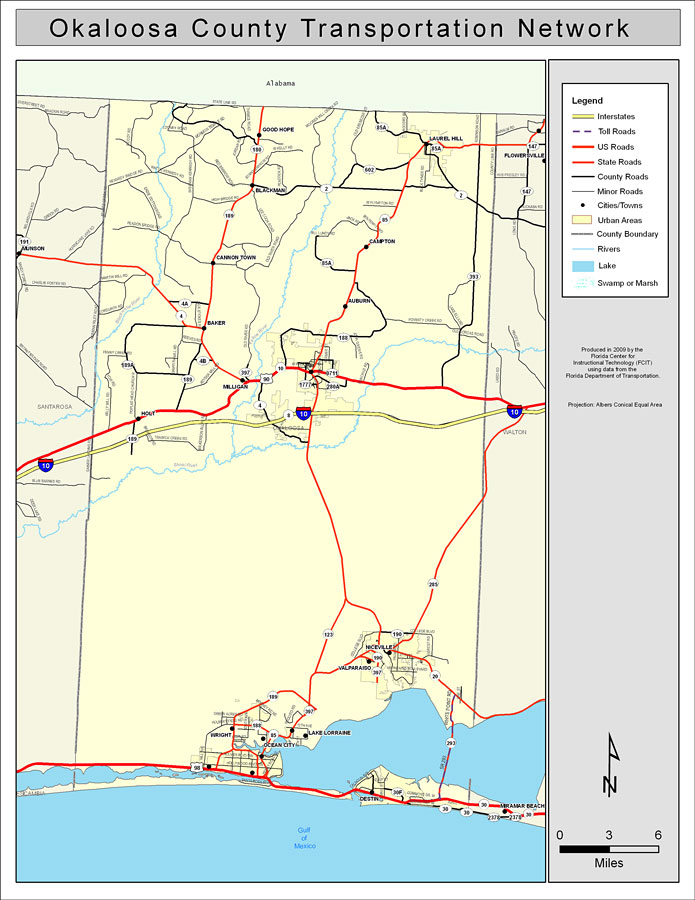
Description: This is a color road map of Okaloosa county, 2009. It shows the location of many roads including US-98 and I-10, cities and towns, and inland water.
Place Names: Okaloosa, Crestview, �Baker, �Blackman, �Milligan, �Niceville, �Lake Lorraine, �Valparaiso, �Wright, �Ocean City, �Destin, �Fort Walton Beach, �Auburn, �Ft. Walton Beach, �Good Hope, �Laurel Hill, �Campton, �Cannon Town, �Holt, �Shoal River, �Gulf of Mexico
ISO Topic Categories: boundaries, �transportation, �inlandWaters, �oceans
Keywords: Okaloosa County Road Network- Color, transportation, �political, �physical, �kroads, �kroadscolor, county borders, roads, boundaries, �transportation, �inlandWaters, �oceans, Albers_Conical_Equal,2009
Source: Florida Center for Instructional Technology, Exploring Florida: Social Studies Resources �for Students and Teachers (Tampa, FL: University of South Florida, 2009)
Map Credit: Courtesy of the Florida Center for Instructional Technology, Author: Samer Slaiby |
|