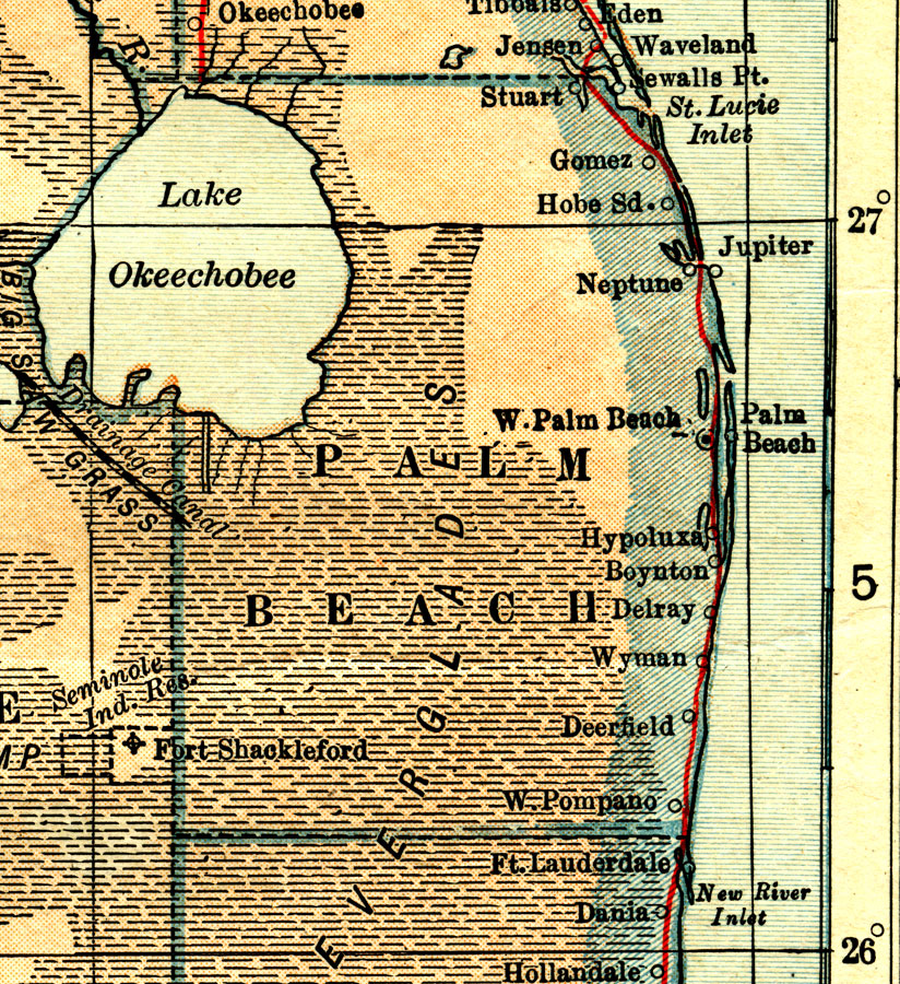
Description: A map of Palm Beach County showing county lines, the county seat (West Palm Beach), the Everglades, railroads, and cities current to 1914.
Place Names: Palm Beach, West Palm Beach, Boynton Beach, Palm Beach, Jupiter
ISO Topic Categories: transportation, inlandWaters, boundaries, oceans
Keywords: Palm Beach County, physical, political, transportation, wetlands, swamps, physical features, county borders, railroads, transportation, inlandWaters, boundaries, oceans, Unknown,1914
Source: L.L. Poates, World Atlas and Gazetteer (New York, NY: P.F. Collier & Son, 1914)
Map Credit: Courtesy the private collection of Roy Winkelman. |
|