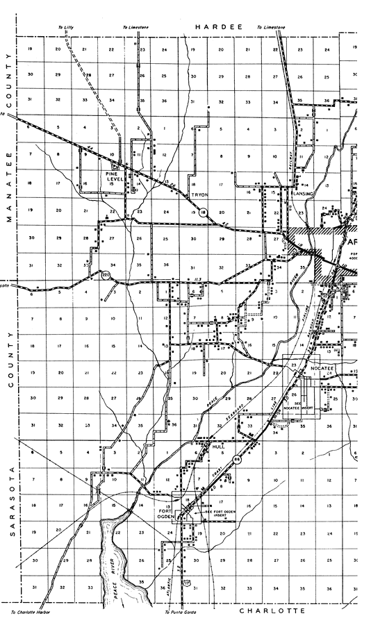
Description: This is a detailed map of the west side of the county of Desoto in the state of Florida. Section Township Range (STR) is shown. This map shows all of the main cities, state roads, US Highways, bridge highways, drawbridge highways, federal aided highway, federal aided secondary highway, saw mills, railroads, inland waters, canals, ferries, corporate lines, county boundary, county seat, camp or lodge, post offices, monuments, mines, turpentine still, cemeteries, churches, farm units, dwellings other than farms, tenant houses, businesses, townhalls, hotels, schools, hospitals and factories. Key to Florida Highway maps.
Place Names: Desoto, Lansing, Nocatee, Peace River, Joshua, Fort Ogden, Pine Level, Tryon
ISO Topic Categories: boundaries, inlandWaters, location, transportation
Keywords: West Desoto, physical, political, transportation, physical features, county borders, major political subdivisions, local jurisdictions, roads, railroads, boundaries, inlandWaters, location, transportation, Unknown,1936
Source: , Florida State Road Department (, FL: , 1936)
Map Credit: Courtesy the private collection of Roy Winkelman. |
|