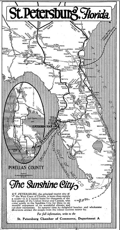
Description: Map shows Florida in its entirety and southern Georgia. map shows all major roads located in Florida during 1922 C.E. Map focuses on St. Peterburg and Pinellas County.
Place Names: 1920-1949, Tampa, St Petersburg, St. Petersburg Beach,
ISO Topic Categories: transportation, oceans, inlandWaters
Keywords: St. Petersburg Florida, physical, transportation, roads, water routes, transportation, oceans, inlandWaters, Unknown,1922
Source: The Automobile Blue Book Corporation, Middle Atlantic and Southeastern Automobile Blue Book 1922 (New York, NY: The Automobile Blue Book Corporation, 1921) 651
Map Credit: Courtesy the private collection of Roy Winkelman |
|