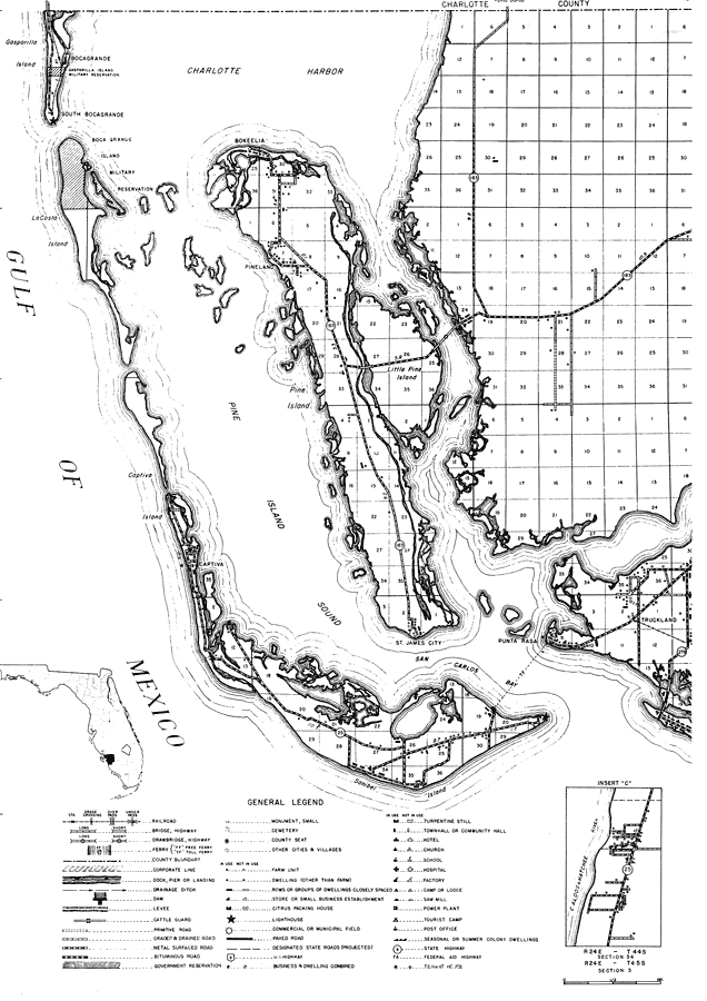
Description: This is a detailed map of the west portion of the county of Lee in the state of Florida. Section Township Range (STR) is shown. This map shows all of the main cities, state roads, railroads, post offices, churches, schools, hotels, sawmills, businesses, tenant houses, townhall, farm units and dwellings other than farms. Key to Florida Highway maps.
Place Names: Lee, Boca Grande, Bokeelia, Gasparilla Island, Pineland, Pine Island, Captiva, Gulf of Mexico, St. James City, Sanibel, Truckland, Punta Rasa, Punta Rassa
ISO Topic Categories: boundaries, location, transportation, inlandWaters, oceans
Keywords: Lee West, physical, political, transportation, physical features, major political subdivisions, local jurisdictions, roads, railroads, boundaries, location, transportation, inlandWaters, oceans, Unknown,1936
Source: , Florida State Road Department (, FL: , 1936)
Map Credit: Courtesy the private collection of Roy Winkelman. |
|