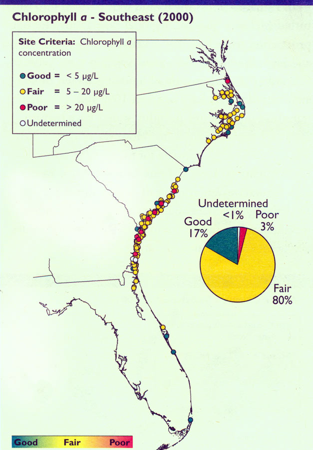
Description: Map of Chlorophyll a concentration data for Southeast Coast Estuaries in 2000 C.E. Levels of chlorophyll a range from good to poor.
Place Names: 2000-,
ISO Topic Categories: economy, oceans, environment
Keywords: Chlorophyll a in Southeast, physical, political, statistical, hydrological, major political subdivisions, economy, oceans, environment, Unknown,2000
Source: , National Coastal Condition Report II (Washington, DC: Environmental Protection Agency, 2004) 115
Map Credit: Courtesy the private collection of Roy Winkelman |
|