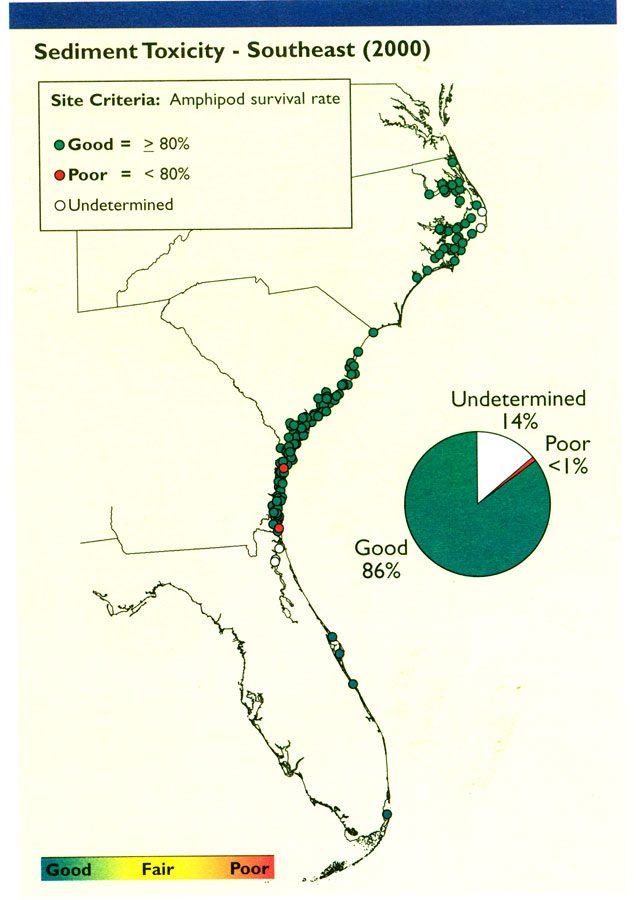
Description: Map shows sediment toxicity data for Southeast Coast estuaries in the United States in 2000 C.E. Levels are good or poor, with good being greater than or equal to 80% amphipod survival rate and poor being less than 80% amphipod survival rate.
Place Names: 2000-,
ISO Topic Categories: economy, oceans, environment
Keywords: Sediment Toxicity in Southeast, hydrological, physical, political, statistical, major political subdivisions, economy, oceans, environment, Unknown,2000
Source: , National Coastal Condition Report II (Washington, DC: Environmental Protection Agency, 2004) 117
Map Credit: Courtesy the private collection of Roy Winkelman |
|