mapsExploring Florida
 FL Maps > County > Desoto > DeSoto County, 1890
Site Map 

DeSoto County, 1890


Puzzle Directions: Click on a puzzle piece and drag it where you want it. When you connect two pieces correctly, they will join together. Mix up the pieces again. View finished map in pop-up window.

Title: DeSoto County
Projection: Unknown
Source Bounding Coordinates:
W: E: N: S:

Back to Map Page
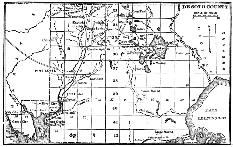
Description: Map shows DeSoto County in 1890 C.E. Shows all major cities, towns, lakes, rivers, roads and railroads present in DeSoto County in 1890 C.E. Shows all counties surrounding DeSoto County.
Source: Charles Ledyard Norton, A Handbook of Florida (New York, NY: Longmans, Green, & Co., 1890) 22
Map Credit: Courtesy the private collection of Roy Winkelman
SearchLicensePDF HelpGIS Help Google Earth Help Zoomify Help

 FL Maps > County > Desoto > DeSoto County, 1890