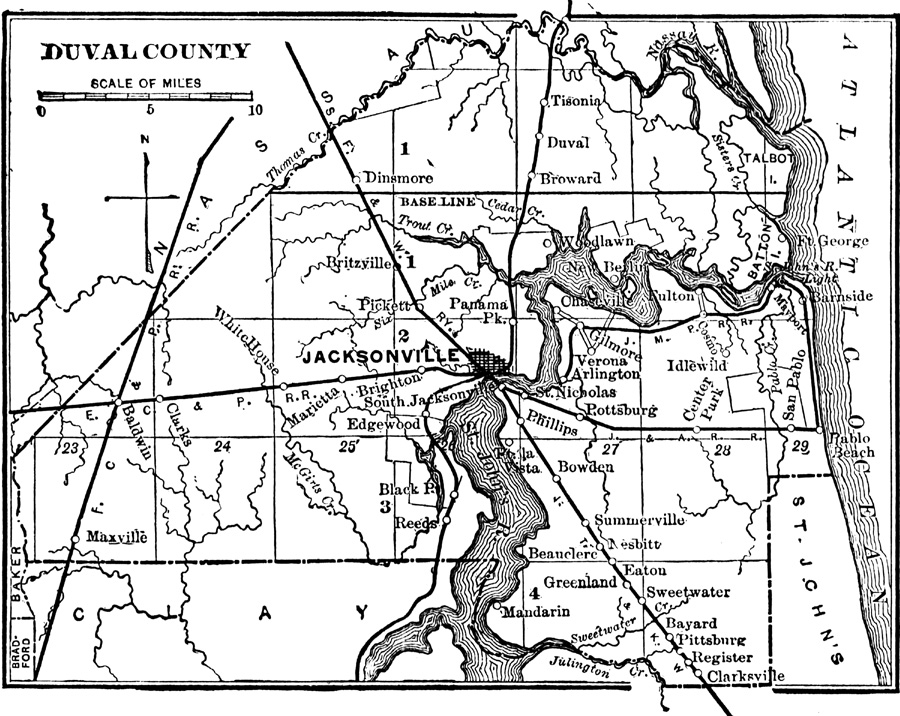
Description: Map shows Duval County in 1890. Shows all major cities, towns, rivers, lakes, roads and railroads present in Duval County in 1890. Shows all counties that surround Duval County and the Atlantic Ocean.
Place Names: Duval, Jacksonville, Edgewood, New Berlin, Maxville, Baldwin, Whitehouse, Mandarin, Pottsburg, Pablo Beach, Mayport, Dinsmore, Pickett
ISO Topic Categories: boundaries, transportation, inlandWaters, oceans
Keywords: Duval County, physical, political, transportation, historical, physical features, county borders, roads, railroads, boundaries, transportation, inlandWaters, oceans, Unknown,1890
Source: Charles Ledyard Norton, A Handbook of Florida (New York, NY: Longmans, Green, & Co., 1890) 24
Map Credit: Courtesy the private collection of Roy Winkelman |
|