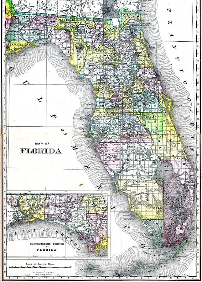
Description: A map of Florida showing county lines, the county seats, railroads, and cities current to 1888. The Everglades and other wetlands are also shown on this map. The Northwestern portion of the state (the Panhandle) is included in an inset map.
Place Names: 1880-1899, Cape Canaveral, Daytona Beach, Fort Myers, Gainesville, Jacksonville, Key West, Miami, Orlando, Pensacola, Saint Augustine, Sarasota, St Petersburg, Tallahassee, Tampa
ISO Topic Categories: transportation, oceans, inlandWaters, boundaries
Keywords: Florida, physical, political, transportation, swamps, wetlands, Everglades, physical features, major political subdivisions, county borders, railroads, transportation, oceans, inlandWaters, boundaries, Unknown,1888
Source: , Atlas of the World (Chicago, IL: Rand McNally & Co., 1888)
Map Credit: Courtesy the private collection of Roy Winkelman |
|