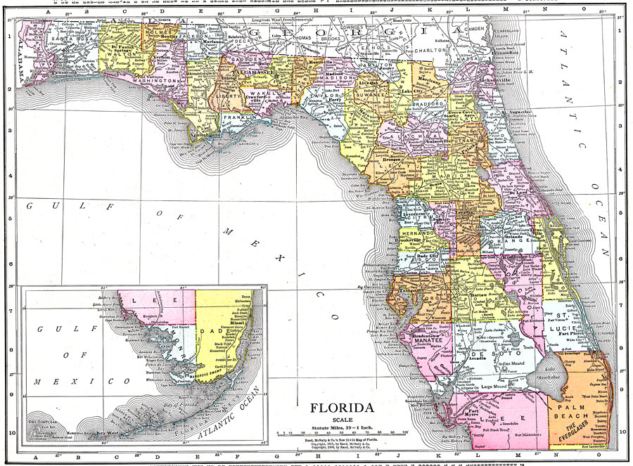
Description: This map of Florida shows county boundaries, wetlands, and railroads connecting major cities current to 1911. There is an inset map of the Southern portion of the state.
Place Names: 1900-1919, Key West, Orlando, Tampa, Cape Canaveral, Saint Augustine, Pensacola, Fort Myers, Fort Lauderdale, Daytona Beach, Gainesville, Jacksonville, Miami, Sarasota, Tallahassee, St Petersburg, West Palm Beach
ISO Topic Categories: boundaries, transportation, inlandWaters, oceans
Keywords: Florida, physical, political, transportation, physical features, county borders, railroads, boundaries, transportation, inlandWaters, oceans, Unknown,1911
Source: , (, : Rand McNally, 1911)
Map Credit: Courtesy the private collection of Roy Winkelman. |
|