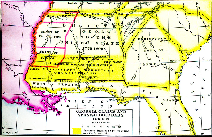
Description: A map of Florida as a Spanish possession stretching from the Mississippi River eastward to the Atlantic Ocean and a northern border line established by the treaties of 1782 and 1783. Florida on this map is shown as East and West Florida with the dividing line on the Perdido River. To the north of Florida is the Mississippi Territory organized in 1798 and claimed by both Spain and the United States in 1783 and 1795. To the north and east is the undisputed area of Georgia. Also shown is the northern line of English West Florida.
Place Names: 1780-1799, Saint Augustine, Pensacola, Apalachicola
ISO Topic Categories: boundaries, inlandWaters, oceans
Keywords: Georgia Claims and Spanish Boundary, political, physical, physical features, major political subdivisions, boundaries, inlandWaters, oceans, Unknown,1789 to 1802
Source: Dixon Ryan Fox, Harper's Atlas of American History (New York, NY: Harper and Brothers, 1920) 21
Map Credit: Courtesy the private collection of Roy Winkelman. |
|