Maps Site map
  FL Maps > Region > 1780-1799
Site Map  

  Record   1   to   18  of   18

Florida and its vicinity, 1781
This map drawn in 1774 is part of a two map set showing the southern peninsula of Florida with neighboring islands and waters. It is primarily a navigational chart with rhumblines, soundings, and coastal features. There are interesting labels such as...

Plano de la bahia de Pansacola, 1782
This is a pen-and-ink and watercolor 1782 map of Pensacola Bay. It shows forts, churches, and Campbelltown pictorially, and includes sailing directions for entering the bay. Relief is shown pictorially, and depths are shown by soundings. ...

Detail - Plano de la bahia de Pansacola, 1782
This detail of Santa Rosa Island and the mouth of Pensacola Bay is from a pen-and-ink and watercolor 1782 map of Pensacola Bay. It shows Fort Barrancas on the mainland and a building on Santa Rosa Island, and includes sailing directions for entering ...

Plano de la ciudad y puerto de San Agustin de la Florida, 1783
Digitization provided by the USF Libraries Digitization Center. Rare Maps. This is a hand colored map of the Saint Augustine region and its port (puerto) with an insert map of Florida and western Cuba [ca. 1:7,000,000]. This map also shows Fuerte Ne...

Peninsula de la Florida, 1783
Digitization provided by the USF Libraries Digitization Center. Rare Maps. This is a map of the Peninsula of Florida showing inland waters and towns in Spanish, circa 1783. It is part of an inset map from a hand colored map of the Saint Augustine reg...

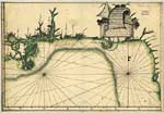
Descripsion de la costa de la Luciana ..., 1784
A pen-and-ink and watercolor map from 1784 of the Gulf Coast between the Anclote Keys in Florida and the mouth of the Mississippi River. Depths shown by soundings, and the submerged Florida platform is shown. The full title of the map is "Descri...

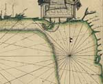
Detail - Descripsion de la costa de la Luciana ..., 1784
A detail of Florida's northwest coastline from a pen-and-ink and watercolor map from 1784 of the Gulf Coast between the Anclote Keys in Florida and the mouth of the Mississippi River. Depths shown by soundings, and the submerged Florida platform is s...

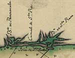
Detail - Descripsion de la costa de la Luciana ..., 1784
A detail Pensacola Bay, Santa Rosa Sound, and Choctawhatchee Bay from a pen-and-ink and watercolor map from 1784 of the Gulf Coast between the Anclote Keys in Florida and the mouth of the Mississippi River. Depths shown by soundings. ...

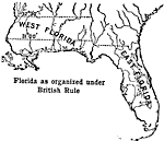
Florida Under British Rule, 1789
Map showing the separation of West Florida and East Florida by the 31 degrees and 32 degrees and 28 minutes. British rule set up this boundary....

Georgia Claims and Spanish Boundary, 1789 to 1802
A map of Florida as a Spanish possession stretching from the Mississippi River eastward to the Atlantic Ocean and a northern border line established by the treaties of 1782 and 1783. Florida on this map is shown as East and West Florida with the divi...

Detail - A general chart of the West Indies, 1796
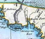
A detail of the Apalachee Bay from a 1796 map of the West Indies showing Cape San Blas, St. George Sound, the Apalachicola River, and the site of St. Marks Fort....

Detail - A general chart of the West Indies, 1796
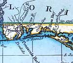
A detail of the area between Pensacola Bay and Santa Rosa Bay from a 1796 map of the West Indies showing Pensacola, Santa Rosa Island, Oyster Cove, Scambia or Escambia River, and Santa Rosa Bay. ...

Detail - A general chart of the West Indies, 1796
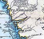
A detail of the northwest Gulf Coast of Florida from a 1796 map of the West Indies showing St. Martins Kays, Cayo del Anclote, the traditional lands of the Tocobagos, and the "Onoquaphenoga or the terrible Swamp.". Depths shown by soundings...

Detail - A general chart of the West Indies, 1796
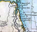
A detail of the northeast Atlantic Coast of Florida from a 1796 map of the West Indies showing St. Marys Inlet, St. Johns Inlet, Matance or Matanzas Inlet, and St. Augustine. On this map, Amelia Island is shown as Egmont Island. Depths shown by sound...

Detail - A general chart of the West Indies, 1796
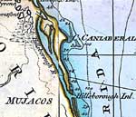
A detail of the Atlantic Coast of Florida near Cape Canaveral from a 1796 map of the West Indies showing Cape Caniaberal or Cape Canaveral, Hillsborough River and Hillsborough Inlet. Depths shown by soundings. ...

Detail - A general chart of the West Indies, 1796
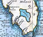
A detail of the Gulf Coast of Florida between Cape Sable and Charlotte Harbor from a 1796 map of the West Indies. The map shows several names from the British occupation that are no longer used such as Lake Mayaco for Lake Okeechobee, Chatham Bay for...

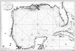
Carte des cotes du Golfe du Mexique : compris entre la pointe Sud de la presqu'lle de la Floride et la pointe Nord de la presqu'lle d'Yucatan : dresse d'apres les observations et les plans des Espagnols, 1799
Digitization provided by the USF Libraries Digitization Center. Rare Maps Collection: G3330 1800 .F73 Notes from USF Library: Relief shown pictorially. "et publiee par order du Ministre de la Marine et des Colonies, au Depot general de la Marine ; gr...

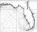
Carte des cotes du Golfe du Mexique : compris entre la pointe Sud de la presqu'lle de la Floride et la pointe Nord de la presqu'lle d'Yucatan : dresse d'apres les observations et les plans des Espagnols, 1799
A detail of Collin's 1799 map showing peninsular Florida. Digitization provided by the USF Libraries Digitization Center. Rare Maps Collection: G3330 1800 .F73 Notes from USF Library: Relief shown pictorially. "et publiee par order du Ministre de la ...


  FL Maps > Region > 1780-1799
Site Map  

Maps ETC is a part of the Educational Technology Clearinghouse
Produced by the Florida Center for Instructional Technology © 2007
College of Education , University of South Florida