mapsExploring Florida
 FL Maps > Region > 1760-1779 > West Florida Under the English, 1763 to 1780
Site Map 

West Florida Under the English, 1763 to 1780


Puzzle Directions: Click on a puzzle piece and drag it where you want it. When you connect two pieces correctly, they will join together. Mix up the pieces again. View finished map in pop-up window.

Title: West Florida Under the English
Projection: Unknown
Source Bounding Coordinates:
W: -95 E: -80 N: 33 S: 28

Back to Map Page
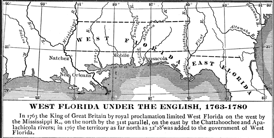
Description: "In 1763 the King of Great Britain by royal proclamation limited West Florida on the west by the Mississippi R., on the north by the 31st parallel, on the east by the Chattahoochee and Apalachicola rivers; in 1767 the territory as far north as 32° 28’ was added to the government of the West Florida." — Fox, 1920
Source: Dixon Ryan Fox, Harper's Atlas of American History (New York, NY: Harper and Brothers, 1920) 26
Map Credit: Courtesy the private collection of Roy Winkelman.
SearchLicensePDF HelpGIS Help Google Earth Help Zoomify Help

 FL Maps > Region > 1760-1779 > West Florida Under the English, 1763 to 1780