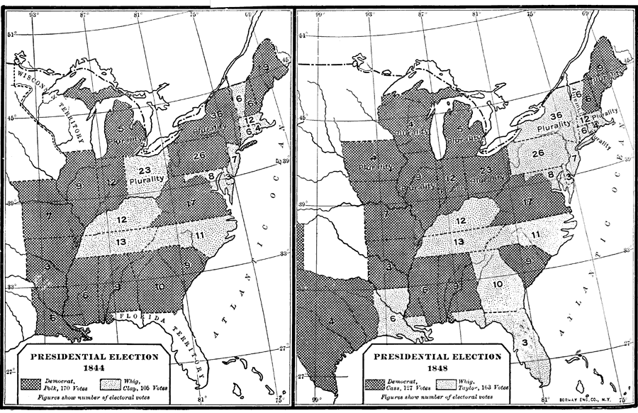
Description: These two maps show the Presidential election results between 1844 and 1848. Florida was not admitted into the Union until March 3, 1845 and therefore did not participate in the 1844 election. In 1848 Florida voted for the Whig Party (Taylor) with 3 electoral votes.
Place Names: 1840-1859,
ISO Topic Categories: boundaries, inlandWaters, oceans, society
Keywords: Presidential Election Results, physical, political, historical, physical features, major political subdivisions, election results, boundaries, inlandWaters, oceans, society, Unknown,1844 to 1848
Source: Dixon Ryan Fox, Harper's Atlas of American History (New York, NY: Harper and Brothers, 1920) 44
Map Credit: Courtesy the private collection of Roy Winkelman. |
|