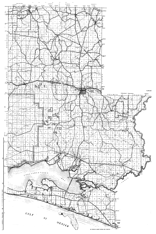
Description: This is a detailed map of the county of Walton in the state of Florida. Section Township Range (STR) is shown. This map shows all of the main cities, state roads, US Highways, bridge highways, drawbridge highways, federal aided highway, saw mills, railroads, inland waters, canals, ferries, corporate lines, county boundaries, county seat, airports, camps or lodges, post offices, turpentine stills, cemeteries, forest ranger lookout station, seasonal dwellings, churches, farm units, dwellings other than farms, tenant houses, businesses, townhalls, hotels, schools, hospitals and factories. Key to Florida Highway maps.
Place Names: Walton, Paxton, Clear Springs, Lakewood, Gaskin, Darlington, Glendale, Coula, Gordon, Stella, Ealum, Union, Walcan, De Funiak Springs, Dixon, Argyle, Tervin, Bron, Mavis, Alpine Heights, Danzig, Bearhead, Mossyhead, Choctawhatchee, Eucheeanna, Knoxhill, Choctawhatchee River, Rockhill, Owl Head, New Home, Alaqua, Hammock Point, Grassy Cove, Villa Tasso, Portland, Freeport, Bruce, Bunker, Fluffy Landing, Mitchells River, Beatrice, Santa Rosa, Hogtown Bayou, Choctawhatchee Bay, Grayton Beach, Point Washington, Choctaw, Seagrove, Alaqua Creek, Euchee Anna, Mossy Head, Red Bay
ISO Topic Categories: boundaries, location, transportation, inlandWaters
Keywords: Walton, physical, political, transportation, physical features, major political subdivisions, local jurisdictions, roads, railroads, boundaries, location, transportation, inlandWaters, Lambert_Conformal_Conic, 1936
Source: , Florida State Road Department (, FL: , 1936)
Map Credit: Courtesy the private collection of Roy Winkelman. |
|