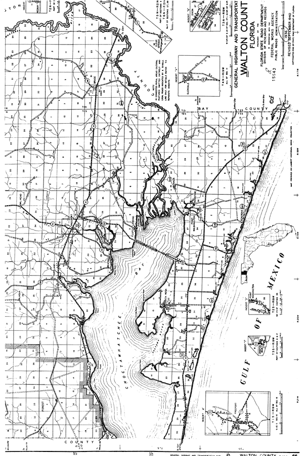
Description: This is a detailed map of the south portion of the county of Walton in the state of Florida. Section Township Range (STR) is shown. This map shows all of the main cities, state roads, US Highways, bridge highways, forest ranger lookout station, businesses, churches, cemeteries, camps, schools, tenant houses, turpentine stills, hotels, post offices, seasonal dwellings, farm units and dwellings other than farms. Key to Florida Highway maps.
Place Names: Walton, Choctawhatchee Bay, Villa Tasso, Grassy Cove, Alaqua, Alaqua Creek, Portland, Freeport, Owl Head, Bruce, Choctawhatchee River, Fluffy Landing, Beatrice, Santa Rosa, Bunker, Point Washington, Choctaw, Grayton Beach, Seagrove Beach
ISO Topic Categories: boundaries, location, transportation, inlandWaters
Keywords: South Walton, physical, political, transportation, physical features, major political subdivisions, local jurisdictions, roads, boundaries, location, transportation, inlandWaters, Lambert_Conformal_Conic, 1936
Source: , Florida State Road Department (, FL: , 1936)
Map Credit: Courtesy the private collection of Roy Winkelman. |
|