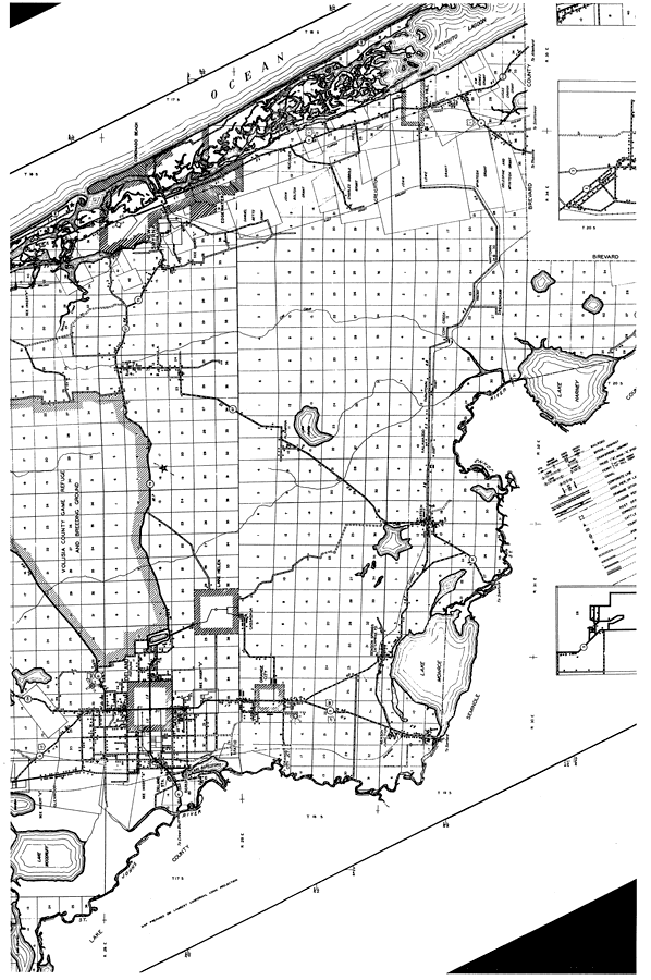
Description: This is a detailed map of the middle portion of the county of Volusia in the state of Florida. Section Township Range (STR) is shown. This map shows all of the main cities, state roads, US Highways, bridge highways, railroads, hospitals, schools, churches, businesses, camps, tenant houses, sawmills, post offices, cemeteries, factories, power plants, turpentine stills, townhalls, airport, county seat, farm units and dwellings other than farms. Key to Florida Highway maps.
Place Names: Volusia, Lake Woodruff, Glenwood, Beresford, Deland, St. Johns River, Samsula, New Smyrna, Edgewater, Hucomer, Ariel, Alamana, Lake Ashby, Lake Helen, Cassadaga, Orange City, Fatio, Lake Beresford, Benson Springs, Lake Monroe, Osteen, Kalamazoo, Farmtown, Cow Creek, Pennichaw, Maytown, Creighton, Mosquito Lagoon, Oak Hill, Atlantic Ocean, Casadaga, Coronado Beach
ISO Topic Categories: boundaries, location, transportation, inlandWaters, oceans
Keywords: Mid Volusia, physical, political, transportation, physical features, major political subdivisions, local jurisdictions, roads, railroads, boundaries, location, transportation, inlandWaters, oceans, Unknown,1936
Source: , Florida State Road Department (, FL: , 1936)
Map Credit: Courtesy the private collection of Roy Winkelman. |
|