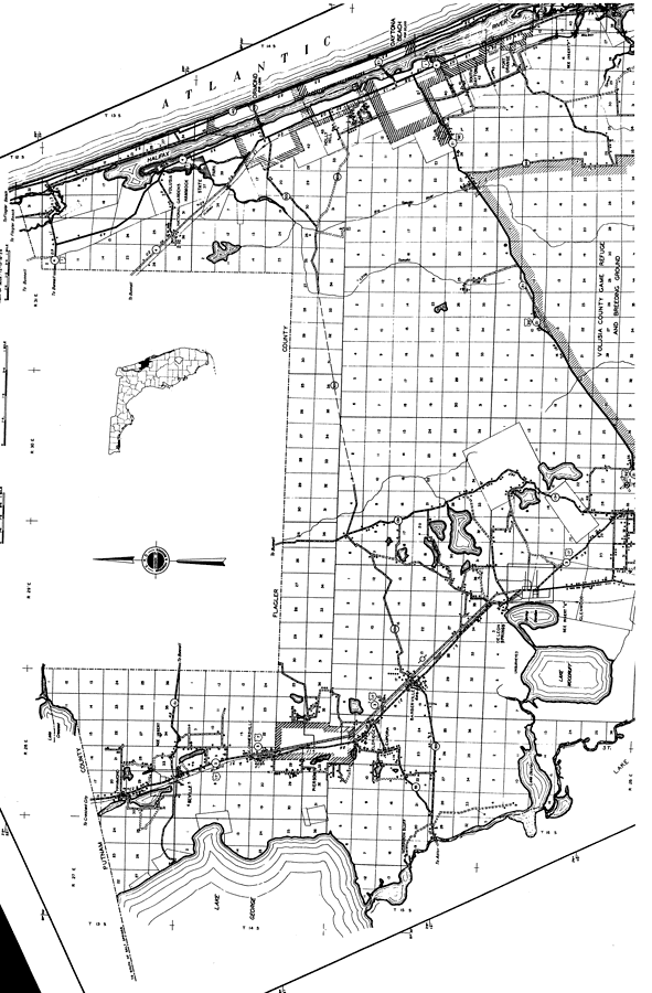
Description: This is a detailed map of the north portion of the county of Volusia in the state of Florida. Section Township Range (STR) is shown. This map shows all of the main cities, state roads, US Highways, bridge highways, railroads, businesses, tenant houses, churches, post offices, airport, cemeteries, schools, sawmills, factories, farm units and dwellings other than farms. Key to Florida Highway maps.
Place Names: Volusia, Hammond, Seville, Connersville, Lake George, Pierson, Eldridge, Emporia, Barberville, Morrison Bluff, Lake Dexter, Lake Woodruff, Glenwood, De Leon Springs, Port Orange, South Daytona, Daytona, Holly Hill, Ormond, Halifax River, Atlantic Ocean, Daytona Beach, Ormond Beach, Allendale
ISO Topic Categories: boundaries, location, transportation, inlandWaters
Keywords: North Volusia, physical, political, transportation, physical features, major political subdivisions, local jurisdictions, roads, railroads, boundaries, location, transportation, inlandWaters, Unknown,1936
Source: , Florida State Road Department (, FL: , 1936)
Map Credit: Courtesy the private collection of Roy Winkelman. |
|