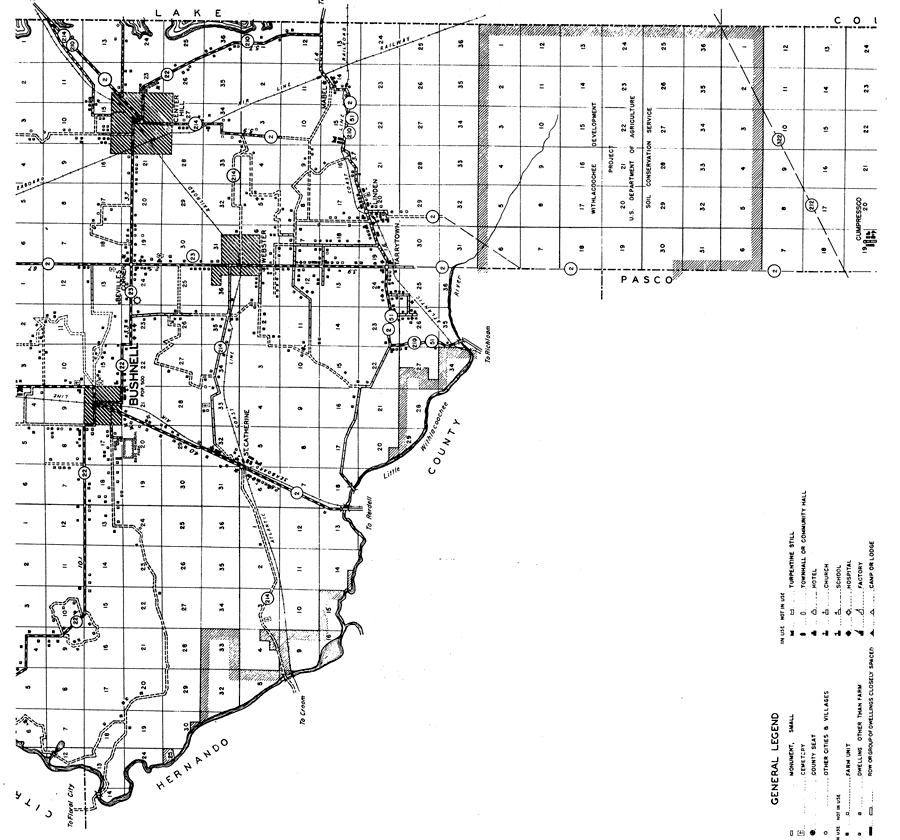
Description: This is a detailed map of the middle portion of the county of Sumter in the state of Florida. Section Township Range (STR) is shown. This map shows all of the main cities, state roads, bridge highways, county seat, sawmills, tenant houses, businesses, cemeteries, churches, schools, post offices, an airport, turpentine stills, farm units and dwellings other than farms. Key to Florida Highway maps.
Place Names: Sumter, Bushnell, St. Catherine, Center Hill, Mabel, Linden, Tarrytown, Cumpressco, Bevilles Corner, Little Withlacoochee River, Webster
ISO Topic Categories: boundaries, location, transportation, inlandWaters
Keywords: Mid Sumter, physical, political, transportation, physical features, major political subdivisions, local jurisdictions, roads, railroads, boundaries, location, transportation, inlandWaters, Mercator, 1936
Source: , Florida State Road Department (, FL: , 1936)
Map Credit: Courtesy the private collection of Roy Winkelman. |
|