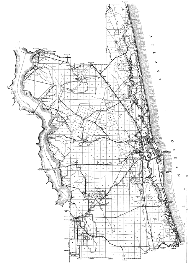
Description: This is a detailed map of the county of St. Johns in the state of Florida. Section Township Range (STR) is shown. This map shows all of the main cities, state roads, US Highways, bridge highways, drawbridge highways, federal aided highway, saw mills, railroads, inland waters, canals, ferries, corporate lines, county boundaries, county seat, airports, camps or lodges, post offices, turpentine stills, cemeteries, forest ranger lookout station, seasonal dwellings, churches, farm units, dwellings other than farms, tenant houses, businesses, townhalls, hotels, schools, hospitals and factories. Key to Florida Highway maps.
Place Names: St. Johns, Ponte Vedra Beach, Ponte Vedra, Palm Valley, Durbin, Atlantic Ocean, Guano River, Sampson Church, Switzerland, Orangedale, Saint Johns River, North River, Palmo, Picolata, Bakersville, Vilano Beach, Vilano, Saint Augustine, College Park, Tocoi, Riverdale, Elkton, Vermont Heights, Tocoi Junction, St. Augustine Beach, Saybrook, Moultrie, Matanzas River, Crescent Beach, Armstrong, Spuds, Hastings, Summer Haven, Yelvington, St. Augustine, Fort Matanzas
ISO Topic Categories: boundaries, location, transportation, inlandWaters, oceans
Keywords: St. Johns, physical, political, transportation, physical features, major political subdivisions, local jurisdictions, roads, railroads, boundaries, location, transportation, inlandWaters, oceans, Lambert_Conformal_Conic, 1936
Source: , Florida State Road Department (, FL: , 1936)
Map Credit: Courtesy the private collection of Roy Winkelman. |
|