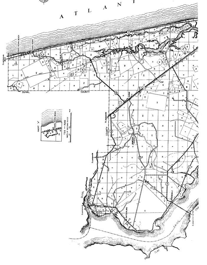
Description: This is a detailed map of the north portion of the county of St. Johns in the state of Florida. Section Township Range (STR) is shown. This map shows all of the main cities, state roads, US Highways, bridge highways, railroads, businesses, schools, churches, post office, sawmill, turpentine still, farm units and dwellings other than farms. Key to Florida Highway maps.
Place Names: St. Johns, Ponte Vedra Beach, Ponte Vedra, Palm Valley, Durbin, Atlantic Ocean, Guano River, North River, Sampson Church, St. Johns River, Switzerland, Orangedale
ISO Topic Categories: boundaries, location, transportation, inlandWaters, oceans
Keywords: North St. Johns, physical, political, transportation, physical features, major political subdivisions, local jurisdictions, roads, boundaries, location, transportation, inlandWaters, oceans, Lambert_Conformal_Conic, 1936
Source: , Florida State Road Department (, FL: , 1936)
Map Credit: Courtesy the private collection of Roy Winkelman. |
|