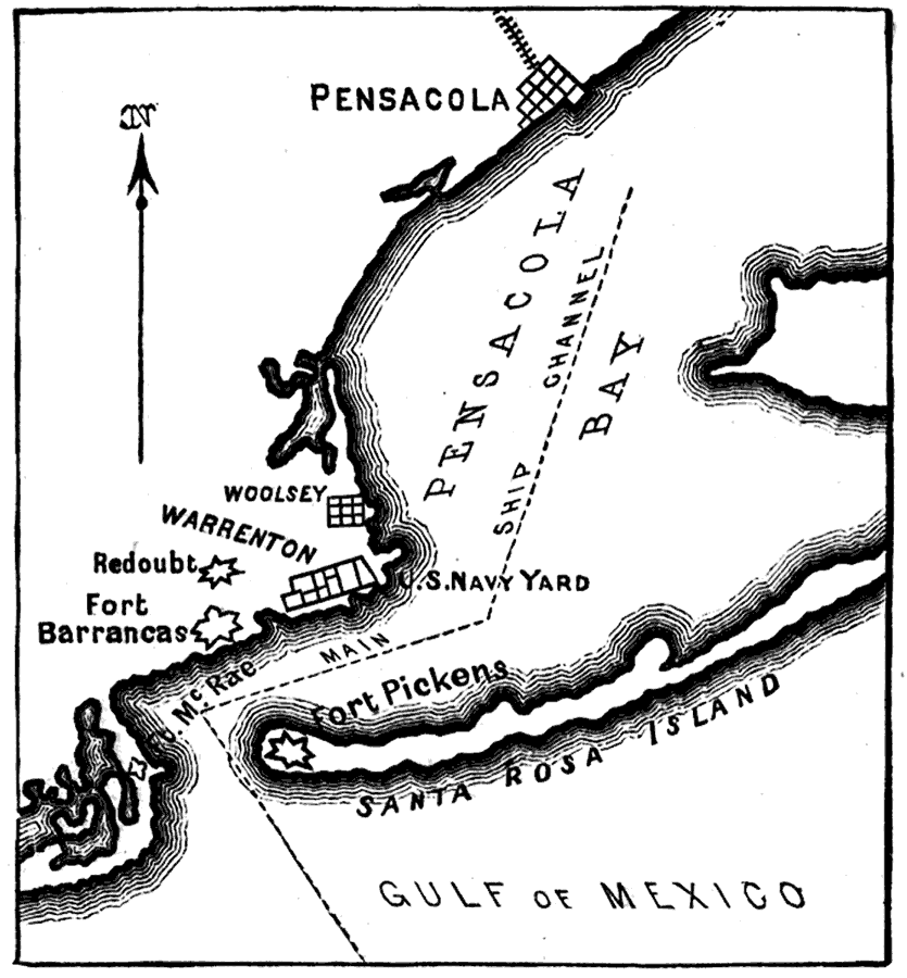
Description: A map of Pensacola Bay at the time of Florida's secession from the union on January 12, 1861. The map shows Fort Barrancas and Fort McRae on the mainland, which quickly came under Confederate control, and Fort Pickens on Santa Rosa Island, which was the only fort on the Atlantic/Gulf shore south of the Chesapeake that remained under Union control throughout the Civil War.
Place Names: Escambia, Warrington, Pensacola, Fort Pickens, Fort Barrancas, Fort McRae, Woolsey
ISO Topic Categories: inlandWaters, oceans, society
Keywords: Map of Pensacola, physical, historical, transportation, physical features, water routes, Civil War, inlandWaters, oceans, society, Unknown,1861
Source: Charles Carleton Coffin, Drum-Beat of the Nation (New York, NY: Harper and Brothers Publishers, 1915) 39
Map Credit: Courtesy the private collection of Roy Winkelman |
|